Garmin GPSMAP 5215 Owner's Manual - Page 17
Perspective 3D Settings, Waypoints & Tracks
 |
View all Garmin GPSMAP 5215 manuals
Add to My Manuals
Save this manual to your list of manuals |
Page 17 highlights
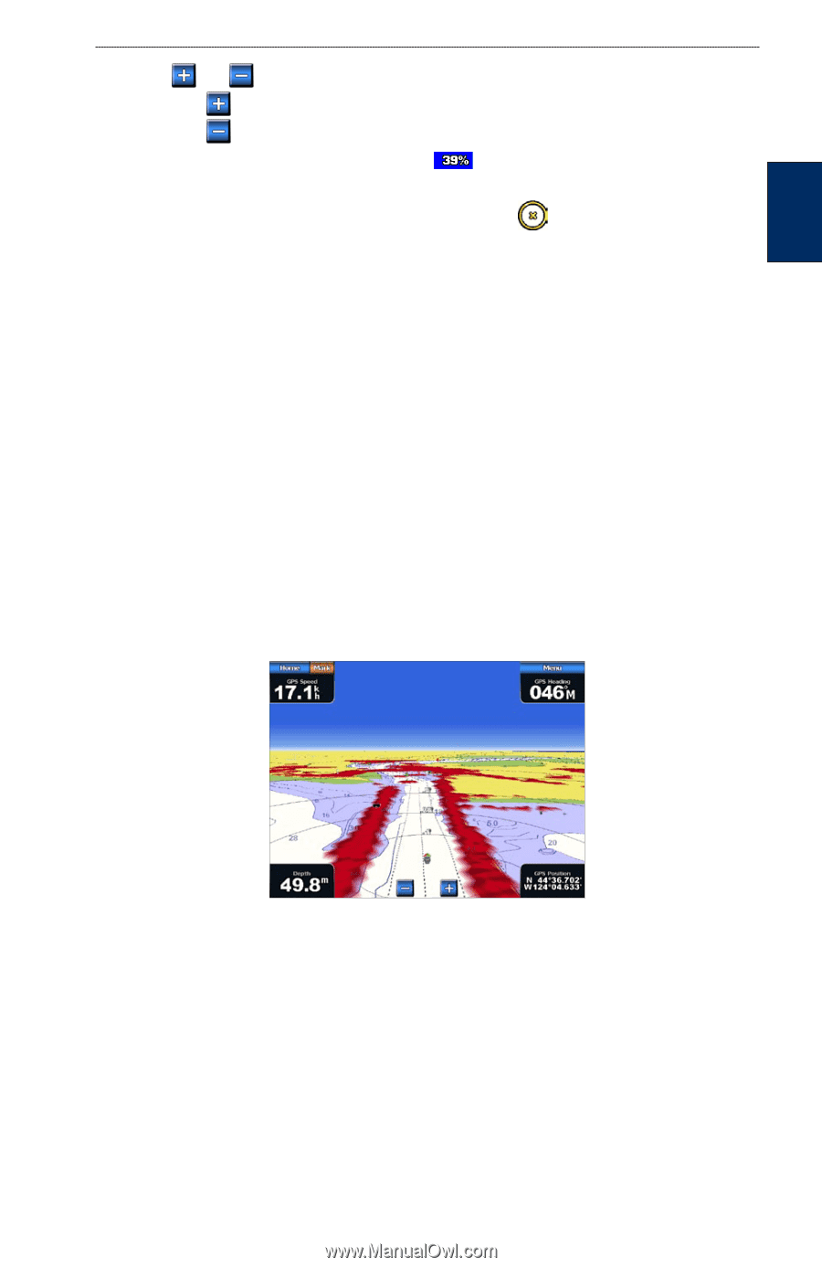
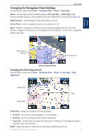
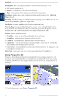
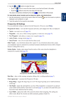
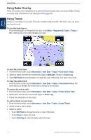
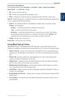
Using Charts Using Charts 2. Use the and buttons to adjust the view: • Touch the button to move the view closer to your boat and lower to the water. • Touch the button to move the view away from the boat. The view is momentarily indicated by the scale ( ) at the bottom of the screen. To view details about navaids such as beacons, lights, and obstructions: 1. Use the touchscreen to point to the navaid. When the cursor displayed, such as Beacon or Light. is over the navaid, an option is 2. Touch the option for the navaid to view details. Perspective 3D Settings To access additional settings or options from the Perspective 3D screen, touch Menu. Waypoints & Tracks-view and add waypoints and tracks, and configure how they are displayed. • Tracks-turn tracks on or off (page 14). • Waypoints-view, sort, or filter existing waypoints, or create new ones (page 25). • New Waypoint-edit, delete, or create a new waypoint (page 25). • Active Tracks-manage tracks (page 14). • Saved Tracks-view a list of tracks that have been saved. Other Vessels-view information about other vessels. To view information about other vessels, your chartplotter must be connected to an external Automatic Identification System (AIS) or Digital Selective Calling (DSC) device. Surface Radar-display radar returns from the surface of the water when the chartplotter is connected to a marine radar (page 48). Perspective 3D With Surface Radar Information Data Bars-show or hide cruising, navigation, fishing, fuel, or sailing numbers (page 7). Chart Appearance-customize the Perspective 3D chart. • Range Rings-toggles the range rings on or off. The range rings help you to visualize distances on the map. • Safe Depth-adjusts the safe depth for your boat. If the chartplotter is connected to an optional sonar module and the shallow water alarm is activated (page 72), an alarm will sound when your boat enters water shallower than this setting. • Lane Width-adjusts the width of the course line drawn when navigating. This setting also affects routes (Route To), but does not affect automatic guidance (Guide To). GPSMAP 5000 Series Owner's Manual 13
-
 1
1 -
2
-
3
-
4
-
5
-
6
-
7
-
8
-
9
-
10
-
11
-
 12
12 -
 13
13 -
 14
14 -
 15
15 -
 16
16 -
 17
17 -
 18
18 -
 19
19 -
 20
20 -
 21
21 -
 22
22 -
23
-
24
-
25
-
26
-
27
-
28
-
29
-
30
-
31
-
32
-
33
-
34
-
35
-
36
-
37
-
38
-
39
-
40
-
41
-
42
-
43
-
44
-
45
-
46
-
47
-
48
-
49
-
50
-
51
-
52
-
53
-
54
-
55
-
56
-
57
-
58
-
59
-
60
-
61
-
62
-
63
-
64
-
65
-
66
-
67
-
68
-
69
-
70
-
71
-
72
-
73
-
74
-
75
-
76
-
77
-
78
-
79
-
80
-
81
-
82
-
83
-
84
 |
 |