Garmin GPSMAP 5215 Owner's Manual - Page 27
Where To?, Navigating to a Destination
 |
View all Garmin GPSMAP 5215 manuals
Add to My Manuals
Save this manual to your list of manuals |
Page 27 highlights
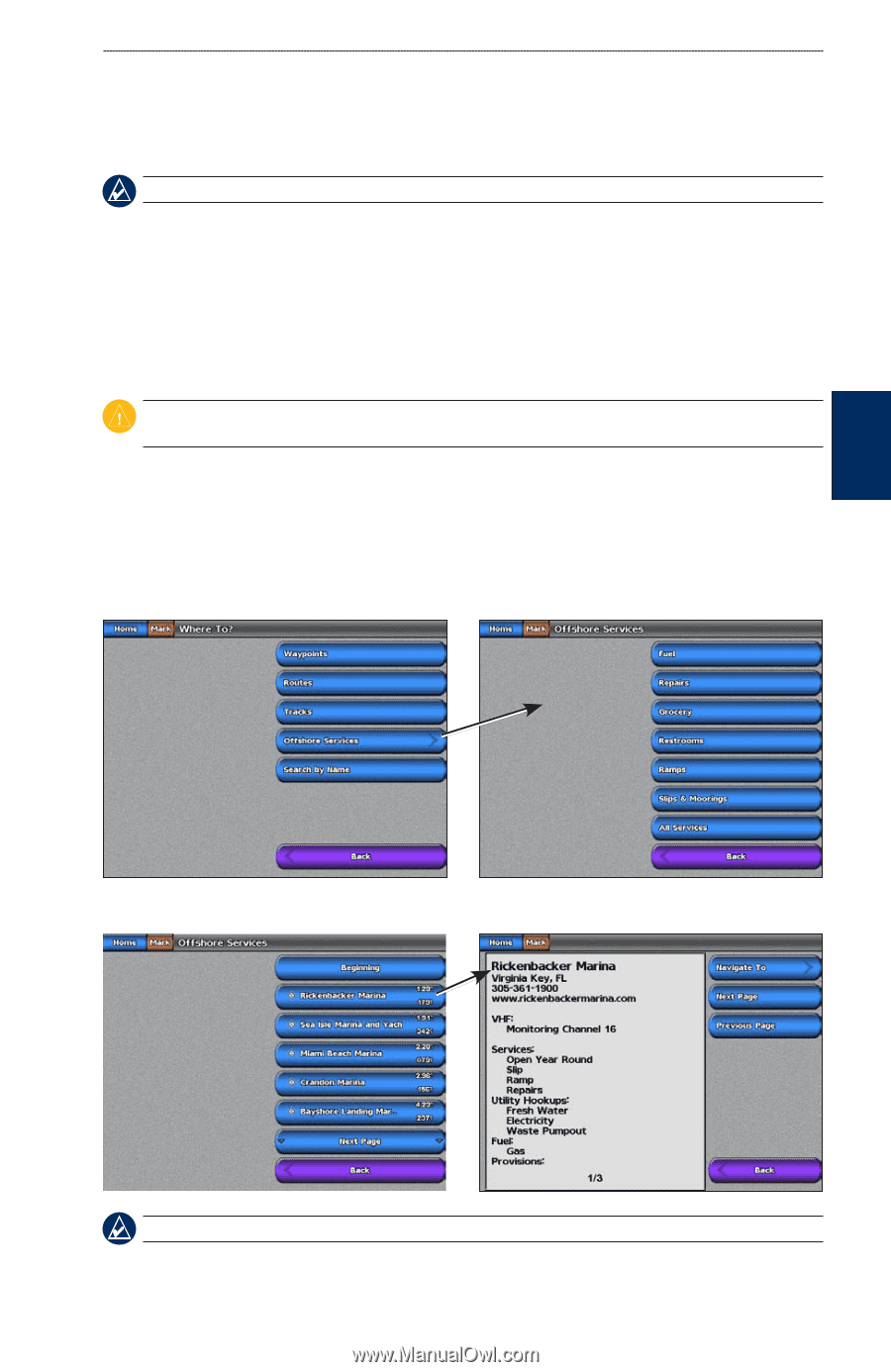
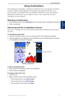
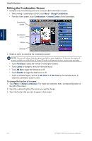
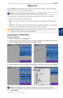
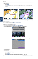
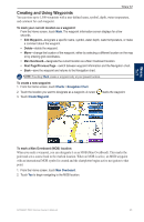
Where To? Where To? Where To? Use the Where To? option on the Home screen to search for and navigate to nearby fuel, repairs, and other services, as well as waypoints and routes. Note: You must create waypoints and routes before you can navigate to them. You can navigate to a destination using one of three methods: Go To, Route To, or Guide To. • Go To-takes you directly to the destination. • Route To-creates a route from your location to a destination, allowing you to add turns to the route. • Guide To-searches BlueChart g2 Vision chart data to suggest the best path to your destination. You must be using a BlueChart g2 Vision SD card for this option to appear. Caution: Guide To does not assure obstacle and bottom clearance. For safety, always resolve any discrepancies or questions before continuing navigation. Navigating to a Destination To begin navigating: 1. From the Home screen, touch Where To?. 2. Touch the marine service category to which you want to navigate. The chartplotter shows the list of the 50 nearest locations and the distance and bearing to each. 3. Select a destination. A screen containing information about the selected marine service appears. Note: Touch Next Page to view additional information or to display the location on a chart. 4. Touch Navigate To. GPSMAP 5000 Series Owner's Manual 23
-
 1
1 -
2
-
3
-
4
-
5
-
6
-
7
-
8
-
9
-
10
-
11
-
12
-
13
-
14
-
15
-
16
-
17
-
18
-
19
-
20
-
21
-
 22
22 -
 23
23 -
 24
24 -
 25
25 -
 26
26 -
 27
27 -
 28
28 -
 29
29 -
 30
30 -
 31
31 -
 32
32 -
33
-
34
-
35
-
36
-
37
-
38
-
39
-
40
-
41
-
42
-
43
-
44
-
45
-
46
-
47
-
48
-
49
-
50
-
51
-
52
-
53
-
54
-
55
-
56
-
57
-
58
-
59
-
60
-
61
-
62
-
63
-
64
-
65
-
66
-
67
-
68
-
69
-
70
-
71
-
72
-
73
-
74
-
75
-
76
-
77
-
78
-
79
-
80
-
81
-
82
-
83
-
84
 |
 |