Garmin GPSMAP 5215 Owner's Manual - Page 65
Viewing Forecast Information, Understanding Marine Warnings
 |
View all Garmin GPSMAP 5215 manuals
Add to My Manuals
Save this manual to your list of manuals |
Page 65 highlights
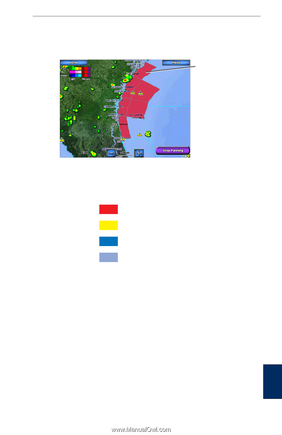
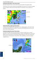
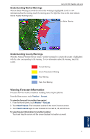
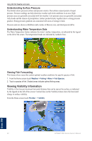
Using XM WX Weather and Audio Understanding Marine Warnings When a Marine Warning is issued, the area for the warning is highlighted in red. To view information about the warning, touch the warning area. The light blue lines on the chart indicate marine weather warning zones. Marine Warning Understanding County Warnings When the National Weather Service issues a weather warning for a county, the county is highlighted with the color corresponding to the warning. To view information about the warning, touch the county. Tornado Warning Severe Thunderstorm Warning Flood Warning Flash Flood Warning Viewing Forecast Information Forecasts show the weather conditions including fronts and precipitation. From the Home screen, touch Weather > Forecast. To view the forecast for another time period: 1. From the Home screen, touch Weather > Forecast. 2. Touch Next Forecast. The forecasted weather for the next 12 hours is shown. 3. Touch Next Forecast again to view forecasts for the next 24, 36, and 48 hours. To view forecast information for another location: Touch and drag the screen until the screen displays the location you want. GPSMAP 5000 Series Owner's Manual 61 Using XM
-
 1
1 -
2
-
3
-
4
-
5
-
6
-
7
-
8
-
9
-
10
-
11
-
12
-
13
-
14
-
15
-
16
-
17
-
18
-
19
-
20
-
21
-
22
-
23
-
24
-
25
-
26
-
27
-
28
-
29
-
30
-
31
-
32
-
33
-
34
-
35
-
36
-
37
-
38
-
39
-
40
-
41
-
42
-
43
-
44
-
45
-
46
-
47
-
48
-
49
-
50
-
51
-
52
-
53
-
54
-
55
-
56
-
57
-
58
-
59
-
 60
60 -
 61
61 -
 62
62 -
 63
63 -
 64
64 -
 65
65 -
 66
66 -
 67
67 -
 68
68 -
 69
69 -
 70
70 -
71
-
72
-
73
-
74
-
75
-
76
-
77
-
78
-
79
-
80
-
81
-
82
-
83
-
84
 |
 |