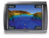
Garmin GPSMAP 5215 Owner's Manual - Page 76
Not All Maps Fit, Some Maps Will Not Be Drawn, MDB Waypoint Memory is Full, Can't Create Waypoint
 |
View all Garmin GPSMAP 5215 manuals
Add to My Manuals
Save this manual to your list of manuals |
Page 76 highlights
Appendix MDB Waypoint Memory is Full, Can't Create Waypoint-MDB waypoint memory is full. Erase existing MDB waypoints to make room. NMEA Depth Is Below Transducer-(sonar) the NMEA depth input is using the DBT sentence which does not include keel offset. No DGPS Position-chartplotter lost differential GPS reception (WAAS). Make sure you have a clear view of the sky. No Proximity Waypoints Found-no proximity waypoints found while attempting a user data transfer. No Routes Found-no routes found while attempting a user data transfer. No Tracks Found-no tracks found while attempting a user data transfer. No User Waypoints Found-no user waypoints found while attempting a user data transfer. No XM Signal-(XM WX weather) no XM satellite signal detected. Make sure you have a clear view of the sky. Not All Maps Fit, Some Maps Will Not Be Drawn-there are more maps present on the SD card than what the chartplotter can support. Some of the maps on the card will not be drawn or used to find map features. Off Course Alarm-the boat has left the user-defined course. Proximity Alarm-the boat has come close to a user-defined proximity point. Proximity Alarm Memory is Full-the proximity waypoint memory is full. Erase existing proximity waypoints to make room. Proximity Overlaps Another Proximity Waypoint-a proximity point is overlapping another proximity waypoint. Radar Guard Zone Alarm-(radar) an object has been detected in the user-defined radar guard zone. Radar Needs Repair Error Code-(radar) the radar needs repair. An error code will be listed to help diagnose the error. Radar Service Incompatible. Software Update Required-a radar software update is needed. Contact product support for assistance updating your network. Radar Service Lost-(radar) the chartplotter has lost communications with the remote radar device. Check the network and the radar wiring. Route Already Exists-the named route already exists. Choose another name. Route is Full-the individual route is full, no more waypoints can be added. Route Memory is Full, Can't Create Route-the chartplotter's route memory as a whole is full, no more routes can be created. Erase existing routes to make room. Route Truncated-some points on the end of the route have been discarded. Severe Storm Warning-(XM WX weather) there is a severe storm warning in effect. Shallow Water Alarm-(sonar) the boat has entered the user-defined shallow water depth. Simulating Operation-the chartplotter is in simulator mode. 72 GPSMAP 5000 Series Owner's Manual
-
 1
1 -
2
-
3
-
4
-
5
-
6
-
7
-
8
-
9
-
10
-
11
-
12
-
13
-
14
-
15
-
16
-
17
-
18
-
19
-
20
-
21
-
22
-
23
-
24
-
25
-
26
-
27
-
28
-
29
-
30
-
31
-
32
-
33
-
34
-
35
-
36
-
37
-
38
-
39
-
40
-
41
-
42
-
43
-
44
-
45
-
46
-
47
-
48
-
49
-
50
-
51
-
52
-
53
-
54
-
55
-
56
-
57
-
58
-
59
-
60
-
61
-
62
-
63
-
64
-
65
-
66
-
67
-
68
-
69
-
70
-
 71
71 -
 72
72 -
 73
73 -
 74
74 -
 75
75 -
 76
76 -
 77
77 -
 78
78 -
 79
79 -
 80
80 -
 81
81 -
82
-
83
-
84
 |
 |