Garmin GPSMAP 67i Owners Manual - Page 15
Starting Tracking, Sharing Your MapShare Web inReach Tracking Settings, SOS, Tracking
 |
View all Garmin GPSMAP 67i manuals
Add to My Manuals
Save this manual to your list of manuals |
Page 15 highlights
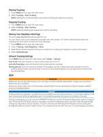
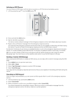
Starting Tracking 1 Press MENU twice to open the main menu. 2 Select Tracking > Start Tracking. NOTE: Starting the Tracking feature also starts recording your path as an activity. Stopping Tracking 1 Press MENU twice to open the main menu. 2 Select Tracking > Stop Tracking. NOTE: Stopping tracking also pauses your activity recording. Sharing Your MapShare Web Page You can enable MapShare at explore.garmin.com. You can share a link to your MapShare web page with other people. The system automatically adds text, including link information, to the end of your message. 1 Press MENU twice to open the main menu. 2 Select Tracking > Send MapShare > Share. 3 Select To to choose recipients from your contacts list, or enter each recipient's contact information. 4 Select Send Message. inReach Tracking Settings Press MENU twice to open the main menu. Select Setup > Tracking. Auto Track: Sets the navigator to start tracking when you turn it on. Link with Recording: Links the track with the current activity recording. Moving Interval: Sets the frequency at which the navigator records a track point and transmits it over the satellite network when you are moving. If you are on a professional plan, you can specify the interval when you are stationary. SOS WARNING Before you can use the SOS function, you must have an active satellite subscription. Always test your device before you use it outdoors. Ensure you have a clear view of the sky when using the SOS function, because this feature requires satellite access to operate properly. NOTICE Some jurisdictions regulate or prohibit the use of satellite communications devices. It is the responsibility of the user to know and follow all applicable laws in the jurisdictions where the device is intended to be used. During an emergency, you can use your GPSMAP 67i device to contact the Garmin ResponseSM center to request help. Pressing the SOS button sends a message to the Garmin Response team, and they notify the appropriate emergency responders of your situation. You can communicate with the Garmin Response team during your emergency while you wait for help to arrive. You should only use the SOS function in a real emergency situation. inReach Features 9
-
 1
1 -
2
-
3
-
4
-
5
-
6
-
7
-
8
-
9
-
 10
10 -
 11
11 -
 12
12 -
 13
13 -
 14
14 -
 15
15 -
 16
16 -
 17
17 -
 18
18 -
 19
19 -
 20
20 -
21
-
22
-
23
-
24
-
25
-
26
-
27
-
28
-
29
-
30
-
31
-
32
-
33
-
34
-
35
-
36
-
37
-
38
-
39
-
40
-
41
-
42
-
43
-
44
-
45
-
46
-
47
-
48
-
49
-
50
-
51
-
52
-
53
-
54
-
55
-
56
-
57
-
58
-
59
-
60
-
61
-
62
-
63
-
64
-
65
-
66
 |
 |