Magellan Triton 400 Manual - English - Page 32
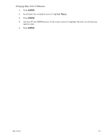
Changing Map Units of Measure - geocache
 |
UPC - 763357117769
View all Magellan Triton 400 manuals
Add to My Manuals
Save this manual to your list of manuals |
Page 32 highlights
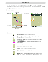
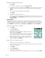
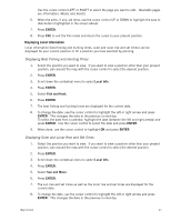
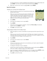
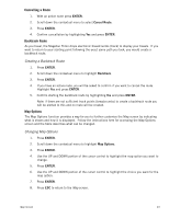
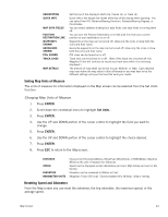
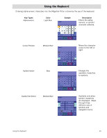
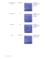
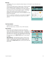
ORIENTATION QUICK INFO MAP DATA FIELDS POSITION DESTINATION LINE WAYPOINTS SHOWN GEOCACHES SHOWN POIs SHOWN TRACK LINES MAP DETAILS Set the top of the display to North Up, Course Up, or Track Up. Quick Info is the header bar shown at the top of the display while panning. You can select from Off, Distance/Bearing Direction, Distance/Bearing Degrees, or Coordinates. You can select between showing four data fields, two data fields or turning them off. You can turn the Position Destination Line (the pink line from your current position to your destination) on or off. Waypoints on the map can be turned off, show only the icons or show both the icons and their name. Geocache waypoints on the map can be turned off, show only the icons or show both the icons and their name POI icons can be turned on or off. Track lines can be turned on or off. (Even if the track line is turned off, the Magellan Triton will continue to record your track even while it is not being displayed.) The amount of map detail can be set to Low, Medium, or High. Each detailed map may define the map detail a little differently so you may have to try the different settings until you find one that suits your needs. Setting Map Units of Measure The units of measure for information displayed on the Map screen can be selected from the Set Units function. Changing Map Units of Measure 1. Press ENTER. 2. Scroll down the contextual menu to highlight Set Units. 3. Press ENTER. 4. Use the UP and DOWN portion of the cursor control to highlight the field you want to change. 5. Press ENTER. 6. Use the UP and DOWN portion of the cursor control to highlight the choice desired. 7. Press ENTER. 8. Press ESC to return to the Map screen. DISTANCE SPEED ELEVATION BAROMETER UNITS Choose from Kilometers/Meters, Miles/Feet, Miles/Yards, or NtMi/Meters (Nautical Miles) as the unit of measure for distances. Speed can be displayed as Kph (kilometers per hour), Mph (miles per hour) or Kts (knots). Elevation can be measured in Meters or Feet. (Magellan Triton 500 only) Choose between kPa, Millibar, inHg or mmHg. Resetting Speed and Odometers From the Map screen you can reset the odometer, the trip odometer, the maximum speed, or the average speed. Map Screen 24
-
 1
1 -
2
-
3
-
4
-
5
-
6
-
7
-
8
-
9
-
10
-
11
-
12
-
13
-
14
-
15
-
16
-
17
-
18
-
19
-
20
-
21
-
22
-
23
-
24
-
25
-
26
-
 27
27 -
 28
28 -
 29
29 -
 30
30 -
 31
31 -
 32
32 -
 33
33 -
 34
34 -
 35
35 -
 36
36 -
 37
37 -
38
-
39
-
40
-
41
-
42
-
43
-
44
-
45
-
46
-
47
-
48
-
49
-
50
-
51
-
52
-
53
-
54
-
55
-
56
-
57
-
58
-
59
-
60
-
61
-
62
-
63
-
64
-
65
 |
 |