Campbell Scientific CSAT3B CSAT3B Three-Dimensional Sonic Anemometer - Page 73
Appendix A. CSAT3B Orientation
 |
View all Campbell Scientific CSAT3B manuals
Add to My Manuals
Save this manual to your list of manuals |
Page 73 highlights
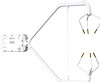
Appendix A. CSAT3B Orientation A.1 Determining True North and Sensor Orientation The orientation of the CSAT3B negative x-axis is found by reading a magnetic compass and applying the site-specific correction for magnetic declination; where the magnetic declination is the number of degrees between True North and Magnetic North. Magnetic declination for a specific site can be obtained from a USGS map, local airport, or through a NOAA web calculator (Appendix A.2, Online Magnetic Declination Calculator). A general map in FIGURE A-1 taken from www.ngdc.noaa.gov/geomag/img/DeclinationMap_US.png shows magnetic declination for the conterminous United States in 2010. FIGURE A-1. Magnetic declination for the conterminous United States (2010) A-1
-
 1
1 -
2
-
3
-
4
-
5
-
6
-
7
-
8
-
9
-
10
-
11
-
12
-
13
-
14
-
15
-
16
-
17
-
18
-
19
-
20
-
21
-
22
-
23
-
24
-
25
-
26
-
27
-
28
-
29
-
30
-
31
-
32
-
33
-
34
-
35
-
36
-
37
-
38
-
39
-
40
-
41
-
42
-
43
-
44
-
45
-
46
-
47
-
48
-
49
-
50
-
51
-
52
-
53
-
54
-
55
-
56
-
57
-
58
-
59
-
60
-
61
-
62
-
63
-
64
-
65
-
66
-
67
-
 68
68 -
 69
69 -
 70
70 -
 71
71 -
 72
72 -
 73
73 -
 74
74 -
 75
75 -
 76
76 -
 77
77 -
 78
78 -
79
-
80
-
81
-
82
-
83
-
84
-
85
-
86
-
87
-
88
 |
 |

Appendix A. CSAT3B Orientation
A.1 Determining True North and Sensor Orientation
The orientation of the CSAT3B negative x-axis is found by reading a magnetic
compass and applying the site-specific correction for magnetic declination;
where the magnetic declination is the number of degrees between True North
and Magnetic North.
Magnetic declination for a specific site can be obtained
from a USGS map, local airport, or through a NOAA web calculator
(Appendix A.2,
Online Magnetic Declination Calculator
).
A general map in
FIGURE A-1 taken from
www.ngdc.noaa.gov/geomag/img/DeclinationMap_US.png
shows magnetic
declination for the conterminous United States in 2010.
FIGURE A-1.
Magnetic declination for the conterminous United States
(2010)
A-1