Garmin eTrex Legend C Owner's Manual - Page 17
Options - guide
 |
UPC - 753759045555
View all Garmin eTrex Legend C manuals
Add to My Manuals
Save this manual to your list of manuals |
Page 17 highlights
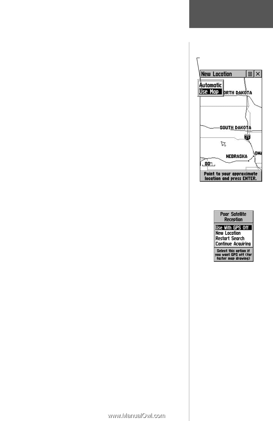
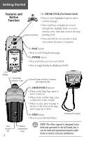
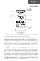
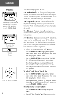
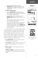
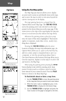
Satellite 3. Enter the desired elevation by using the THUMB STICK to highlight the desired numerals and pressing it in. Highlight 'OK' and press in to complete entry. To enter a new location: 1. Use the THUMB STICK to highlight the Option Menu button at the top of the page and then press it in to display the Options Menu. 2. Highlight 'New Location' and press in on the THUMB STICK to display choices of 'Auto' or 'Use Map'. If you choose 'Auto' the eTrex Legend determines your new location automatically. If you choose 'Use Map' a map page displays with instructions stating, "Point to your approximate location and press ENTER". Use the THUMB STICK to move the map pointer to your location on the map and press it in. The eTrex Legend relies on satellite signals to provide navigational guidance, so getting a clear view of the sky is necessary because GPS signals do not travel through rocks, buildings, people, metal, or heavy tree cover. At least three satellite signals are needed to determine your location, otherwise the unit displays a "Poor Satellite Reception" message. This message provides four options and a brief explanation to guide your choice: Use with GPS Off - Select this option if you want GPS off (for faster map drawing). New Location - Select this option if you have moved hundreds of miles (from where you last used the unit). Restart Search - Select this option if today is not (date provided). Continue Acquiring - Select this option if no other option applies. (The unit will attempt to gather GPS signals.) Options 'Use Map' option helps to speed acquisition. There are four options for the "Poor Satellite Reception" message. 7
-
 1
1 -
2
-
3
-
4
-
5
-
6
-
7
-
8
-
9
-
10
-
11
-
 12
12 -
 13
13 -
 14
14 -
 15
15 -
 16
16 -
 17
17 -
 18
18 -
 19
19 -
 20
20 -
 21
21 -
 22
22 -
23
-
24
-
25
-
26
-
27
-
28
-
29
-
30
-
31
-
32
-
33
-
34
-
35
-
36
-
37
-
38
-
39
-
40
-
41
-
42
-
43
-
44
-
45
-
46
-
47
-
48
-
49
-
50
-
51
-
52
-
53
-
54
-
55
-
56
-
57
-
58
-
59
-
60
-
61
-
62
-
63
-
64
-
65
-
66
-
67
-
68
-
69
-
70
-
71
-
72
-
73
-
74
-
75
-
76
 |
 |