Garmin eTrex Legend C Owner's Manual - Page 24
Setup Options - color
 |
UPC - 753759045555
View all Garmin eTrex Legend C manuals
Add to My Manuals
Save this manual to your list of manuals |
Page 24 highlights
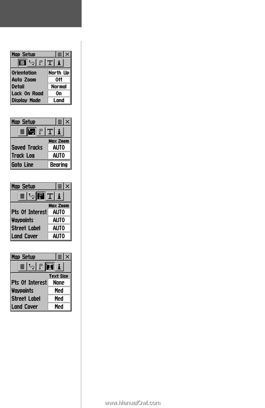
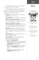
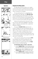
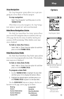
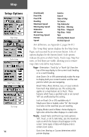
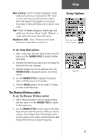
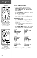
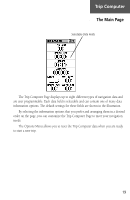
Map Setup Options Page Setup Tracks Setup Map Features Setup Text Setup 14 (Continued) Final ETA Final ETE Heading Maximum Speed Moving Avg. Speed Odometer Off Course Overall Avg. Speed Pointer Speed Sunrise Sunset Time of Day To Course Trip Odometer Trip Time - Moving Trip Time - Stopped Trip Time - Total Turn Velocity Made Good Vertical Speed (For definitions, see Appendix C, pages 54-55.) The 'Setup Map' option displays the five Map Setup Pages, each accessed by an on-screen button. A list of options displays for the features listed. Scale options indicate the point at which Tracks, Tracks Logs, Map Features, or Text Boxes are visible, allowing you to remove map clutter and define map features. Page - Orientation: 'Track Up' or 'North Up'; fixes the top of the map display to the current track heading or to a north heading. Auto Zoom: On or Off; automatically scales the map to display both your current location and the next point to which you are navigating. Detail: Most, More, Normal, Less, or Least; controls how much map detail you see. This setting only applies to a map feature set to 'Auto'. Those features which have a specified scale or are turned 'Off' are unaffected by this setting. Lock on Road: On or Off; available only if MapSource Data is loaded; when 'On' the triangle icon locks to the road that you are traveling. Display Mode: Land or Water; choice displays in light color while the other displays in a dark color. Tracks - Saved Tracks and Track Log: Scale options; 'Off', 'Auto', or 20 ft.-500 miles, sets the maximum scale at which the feature should appear on the screen. Some types of data will display only to certain zoom scales. Goto Line: Bearing or Course; determines which pointer displays.
-
 1
1 -
2
-
3
-
4
-
5
-
6
-
7
-
8
-
9
-
10
-
11
-
12
-
13
-
14
-
15
-
16
-
17
-
18
-
 19
19 -
 20
20 -
 21
21 -
 22
22 -
 23
23 -
 24
24 -
 25
25 -
 26
26 -
 27
27 -
 28
28 -
 29
29 -
30
-
31
-
32
-
33
-
34
-
35
-
36
-
37
-
38
-
39
-
40
-
41
-
42
-
43
-
44
-
45
-
46
-
47
-
48
-
49
-
50
-
51
-
52
-
53
-
54
-
55
-
56
-
57
-
58
-
59
-
60
-
61
-
62
-
63
-
64
-
65
-
66
-
67
-
68
-
69
-
70
-
71
-
72
-
73
-
74
-
75
-
76
 |
 |