Uniden BCT15 English Owners Manual - Page 127
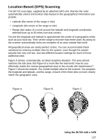
Location-Based (GPS) Scanning, A shows, schematically
 |
View all Uniden BCT15 manuals
Add to My Manuals
Save this manual to your list of manuals |
Page 127 highlights
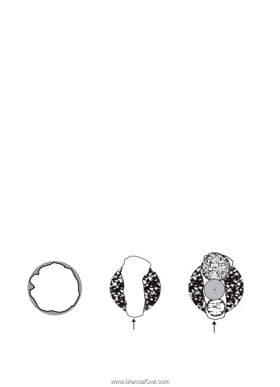
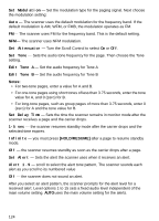
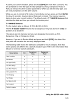
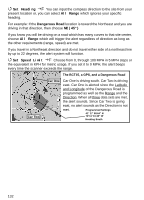
Location-Based (GPS) Scanning The BCT15 uses data, supplied by an attached GPS unit, that lets the radio automatically unlock and lockout sites based on the geographical information you provide. • Latitude (the center of the range or site) • Longitude (the center of the range or site) • Range (the radius of a circle around the latitude and longitude coordinates selected from up to 50 miles from that center). You set the longitude and latitude to approximate the center of a geographic entity such as your local city. Then set the range to encircle that center point. By doing so the scanner automatically locks out reception of an area outside that circle. All geopolitical areas are rarely perfect circles. You can accommodate these variations by entering multiple sites for the system, even though the system actually has only one site, and use different location settings for each of those additional sites. Figure A shows, schematically, an ideal reception situation. The area almost matches the site area. But Figure B is more like the real world. How do you effectively match the narrow geographical area to the circular site transmission? Figure C shows the answer. You create multiple sites for the scanner. You program the longitude and latitude, and the range, of each of the three sites to more closely match the geographic area. Figure A Figure B Figure C Using the BCT15 with a GPS 127
-
 1
1 -
2
-
3
-
4
-
5
-
6
-
7
-
8
-
9
-
10
-
11
-
12
-
13
-
14
-
15
-
16
-
17
-
18
-
19
-
20
-
21
-
22
-
23
-
24
-
25
-
26
-
27
-
28
-
29
-
30
-
31
-
32
-
33
-
34
-
35
-
36
-
37
-
38
-
39
-
40
-
41
-
42
-
43
-
44
-
45
-
46
-
47
-
48
-
49
-
50
-
51
-
52
-
53
-
54
-
55
-
56
-
57
-
58
-
59
-
60
-
61
-
62
-
63
-
64
-
65
-
66
-
67
-
68
-
69
-
70
-
71
-
72
-
73
-
74
-
75
-
76
-
77
-
78
-
79
-
80
-
81
-
82
-
83
-
84
-
85
-
86
-
87
-
88
-
89
-
90
-
91
-
92
-
93
-
94
-
95
-
96
-
97
-
98
-
99
-
100
-
101
-
102
-
103
-
104
-
105
-
106
-
107
-
108
-
109
-
110
-
111
-
112
-
113
-
114
-
115
-
116
-
117
-
118
-
119
-
120
-
121
-
 122
122 -
 123
123 -
 124
124 -
 125
125 -
 126
126 -
 127
127 -
 128
128 -
 129
129 -
 130
130 -
 131
131 -
 132
132 -
133
-
134
-
135
-
136
-
137
-
138
-
139
-
140
-
141
-
142
-
143
-
144
-
145
-
146
-
147
-
148
-
149
-
150
-
151
-
152
 |
 |