Garmin Astro Astro and DC 40 Owner's Manual - Page 28
Altimeter, Set Course, Project Location, Re-Sight, Calibrate Compass, Start, Advanced
 |
UPC - 753759063931
View all Garmin Astro manuals
Add to My Manuals
Save this manual to your list of manuals |
Page 28 highlights
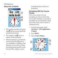
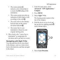
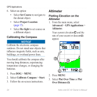
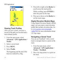
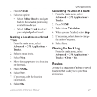
GPS Applications 6. Select an option: • Select Set Course to navigate to the distant object. • Select Project Location (page 15). • Select Re-Sight to set course on a different object. Calibrating the Compass notice Calibrate the electronic compass outdoors. Do not stand near objects that influence magnetic fields, such as cars, buildings, or overhead power lines. You should calibrate the compass after moving long distances, experiencing temperature changes, or changing the batteries. 1. Press DOG > MENU. 2. Select Calibrate Compass > Start. 3. Follow the on-screen instructions. Altimeter Plotting Elevation on the Altimeter 1. From the main menu, select Advanced > GPS Applications > Altimeter. Your current elevation ➊ and the rate of your ascent or descent ➋ appear. ➍ ➌ ➋ ➊ 2. Press MENU. 3. Select Plot Over Time or Plot Over Distance ➌. 24 Astro and DC 40 Owner's Manual
-
 1
1 -
2
-
3
-
4
-
5
-
6
-
7
-
8
-
9
-
10
-
11
-
12
-
13
-
14
-
15
-
16
-
17
-
18
-
19
-
20
-
21
-
22
-
 23
23 -
 24
24 -
 25
25 -
 26
26 -
 27
27 -
 28
28 -
 29
29 -
 30
30 -
 31
31 -
 32
32 -
 33
33 -
34
-
35
-
36
-
37
-
38
-
39
-
40
-
41
-
42
-
43
-
44
-
45
-
46
-
47
-
48
-
49
-
50
-
51
-
52
-
53
-
54
-
55
-
56
-
57
-
58
-
59
-
60
-
61
-
62
-
63
-
64
-
65
-
66
-
67
-
68
-
69
-
70
-
71
-
72
-
73
-
74
-
75
-
76
-
77
-
78
-
79
-
80
-
81
-
82
-
83
-
84
 |
 |
