Garmin Astro Astro and DC 40 Owner's Manual - Page 33
Routes, Marking a Location on a Saved, Track, Calculating the Area of a Track, Clearing the Track Log
 |
UPC - 753759063931
View all Garmin Astro manuals
Add to My Manuals
Save this manual to your list of manuals |
Page 33 highlights
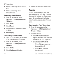
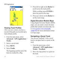
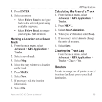
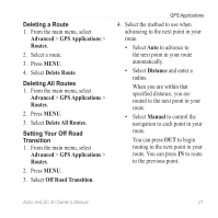
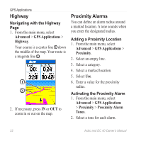
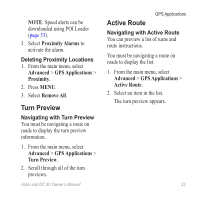
3. Press ENTER. 4. Select an option: • Select Follow Road to navigate back to the selected point using available roadways. • Select Follow Track to retrace your original path of travel. Marking a Location on a Saved Track 1. From the main menu, select Advanced > GPS Applications > Tracks. 2. Select a saved track. 3. Select Map. 4. Move the map pointer to a location on the track. 5. Press MARK. 6. Select New. 7. If necessary, edit the location information. 8. Select OK. GPS Applications Calculating the Area of a Track 1. From the main menu, select Advanced > GPS Applications > Tracks. 2. Press MENU. 3. Select Area Calculation. 4. When you are finished, select Stop. 5. If necessary, select Area to change the units of measure. 6. Select Save. Clearing the Track Log From the main menu, select Advanced > GPS Applications > Tracks > Clear > Yes. Routes A route is a sequence of points or saved locations that leads you to your final destination. Astro and DC 40 Owner's Manual 29
-
 1
1 -
2
-
3
-
4
-
5
-
6
-
7
-
8
-
9
-
10
-
11
-
12
-
13
-
14
-
15
-
16
-
17
-
18
-
19
-
20
-
21
-
22
-
23
-
24
-
25
-
26
-
27
-
 28
28 -
 29
29 -
 30
30 -
 31
31 -
 32
32 -
 33
33 -
 34
34 -
 35
35 -
 36
36 -
 37
37 -
 38
38 -
39
-
40
-
41
-
42
-
43
-
44
-
45
-
46
-
47
-
48
-
49
-
50
-
51
-
52
-
53
-
54
-
55
-
56
-
57
-
58
-
59
-
60
-
61
-
62
-
63
-
64
-
65
-
66
-
67
-
68
-
69
-
70
-
71
-
72
-
73
-
74
-
75
-
76
-
77
-
78
-
79
-
80
-
81
-
82
-
83
-
84
 |
 |
