Garmin GPSMAP 527 Owner's Manual - Page 52
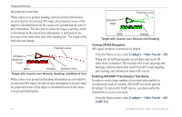
Mariner's Eye 3D charts and Fish Eye 3D charts are, Navigation Chart, Fishing Chart, Perspective 3D
 |
View all Garmin GPSMAP 527 manuals
Add to My Manuals
Save this manual to your list of manuals |
Page 52 highlights
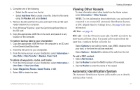
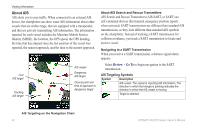
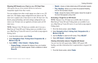
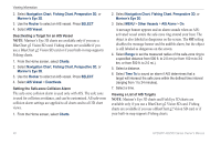
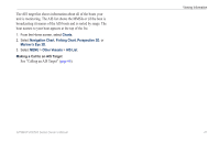
Viewing Information 2. Select Navigation Chart, Fishing Chart, Perspective 3D, or Mariner's Eye 3D. 3. Use the Rocker to select an AIS vessel. Press SELECT. 4. Select AIS Vessel. Deactivating a Target for an AIS Vessel Note: Mariner's Eye 3D charts are available only if you use a BlueChart g2 Vision SD card. Fishing charts are available if you use a BlueChart g2 Vision SD card or if your built-in map supports Fishing charts. 1. From the Home screen, select Charts. 2. Select Navigation Chart, Fishing Chart, Perspective 3D, or Mariner's Eye 3D. 3. Use the Rocker to select an AIS vessel. Press SELECT. 4. Select AIS Vessel > Deactivate. Setting the Safe-zone Collision Alarm The safe-zone collision alarm is used only with AIS. The safe zone is used for collision avoidance, and can be customized. All safe-zone collision alarm settings are applied to all charts and to all 3D chart views. 1. From the Home screen, select Charts. 2. Select Navigation Chart, Fishing Chart, Perspective 3D, or Mariner's Eye 3D. 3. Select MENU > Other Vessels > AIS Alarm > On. A message banner appears and an alarm sounds when an AISactivated vessel enters the safe-zone ring around your boat. The object is also labeled as dangerous on the screen. The Off setting disables the message banner and the audible alarm, but the object is still labeled as dangerous on the screen. 4. Select Range to set the measured radius of the safe-zone ring to a specified distance from 500 ft. to 2.0 nm (or from 150 m to 3.0 km, or from 500 ft. to 2.0 mi.). 5. Select a distance. 6. Select Time To to sound an alarm if AIS determines that a target will intersect the safe zone within the defined time interval (ranging from 1 to 24 minutes). 7. Select a time. Viewing a List of AIS Targets Note: Mariner's Eye 3D charts and Fish Eye 3D charts are available only if you use a BlueChart g2 Vision SD card. Fishing charts are available if you use a BlueChart g2 Vision SD card or if your built-in map supports Fishing charts. 46 GPSMAP 400/500 Series Owner's Manual
-
 1
1 -
2
-
3
-
4
-
5
-
6
-
7
-
8
-
9
-
10
-
11
-
12
-
13
-
14
-
15
-
16
-
17
-
18
-
19
-
20
-
21
-
22
-
23
-
24
-
25
-
26
-
27
-
28
-
29
-
30
-
31
-
32
-
33
-
34
-
35
-
36
-
37
-
38
-
39
-
40
-
41
-
42
-
43
-
44
-
45
-
46
-
 47
47 -
 48
48 -
 49
49 -
 50
50 -
 51
51 -
 52
52 -
 53
53 -
 54
54 -
 55
55 -
 56
56 -
 57
57 -
58
-
59
-
60
-
61
-
62
-
63
-
64
-
65
-
66
-
67
-
68
-
69
-
70
-
71
-
72
-
73
-
74
-
75
-
76
-
77
-
78
-
79
-
80
-
81
-
82
-
83
-
84
 |
 |