Garmin GPSMAP 527 Owner's Manual - Page 55
Configuring Units of Measure, Changing the System Language, SYstem Units, Custom, HeaDing
 |
View all Garmin GPSMAP 527 manuals
Add to My Manuals
Save this manual to your list of manuals |
Page 55 highlights
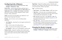
Configuring Units of Measure To change units of measure from the Home screen, select Configure > Preferences > Units. System Units-a global setting that defines individual units of measure at the same time: Statute (mh, ft, ºF), Metric (kh, m, ºC), Nautical (kt, ft, ºF), or Custom. Select Custom to individually define units of measure for depth, temperature, distance, speed, elevation, volume, and pressure. Note: You must be receiving NMEA sonar depth data to view depth and water temperature information. Heading-sets the reference used in calculating heading information. • Auto Magnetic-automatically sets the magnetic declination for your location. • True-sets true north as the heading reference. • Grid-sets grid north as the heading reference (000º). • User Magnetic-allows you to set the magnetic variation value. Position Format-change the coordinate style in which a given location reading appears. Do not change the position format unless you are using a map or chart that specifies a different position format. Configuring the Chartplotter Map Datum-change the coordinate system in which the map is structured. Do not change the map datum unless you are using a map or chart that specifies a different map datum. Time-set the time options. • Time Format-select 12-hour, 24-hour, or UTC time format. • Time Zone-set the time zone you want displayed for time readings. If Auto is selected for the Time Zone, the DST option is not available and is automatically set to Auto. • DST (Daylight Saving Time)-select Off, On, or Auto. The auto setting automatically turns daylight saving time on or off, depending on the time of year. • Baro. Ref. Time-specify the reference time (from 30 minutes to 24 hours) used to calculate the barometric pressure trend. The trend is displayed on the wind gauge when ground wind is selected (page 36) or on the Cruising data bar (page 9). Changing the System Language To change the system language, from the Home screen, select Configure > Preferences > Language. Select the language. GPSMAP 400/500 Series Owner's Manual 49
-
 1
1 -
2
-
3
-
4
-
5
-
6
-
7
-
8
-
9
-
10
-
11
-
12
-
13
-
14
-
15
-
16
-
17
-
18
-
19
-
20
-
21
-
22
-
23
-
24
-
25
-
26
-
27
-
28
-
29
-
30
-
31
-
32
-
33
-
34
-
35
-
36
-
37
-
38
-
39
-
40
-
41
-
42
-
43
-
44
-
45
-
46
-
47
-
48
-
49
-
 50
50 -
 51
51 -
 52
52 -
 53
53 -
 54
54 -
 55
55 -
 56
56 -
 57
57 -
 58
58 -
 59
59 -
 60
60 -
61
-
62
-
63
-
64
-
65
-
66
-
67
-
68
-
69
-
70
-
71
-
72
-
73
-
74
-
75
-
76
-
77
-
78
-
79
-
80
-
81
-
82
-
83
-
84
 |
 |