Garmin GPSMAP 527 Owner's Manual - Page 9
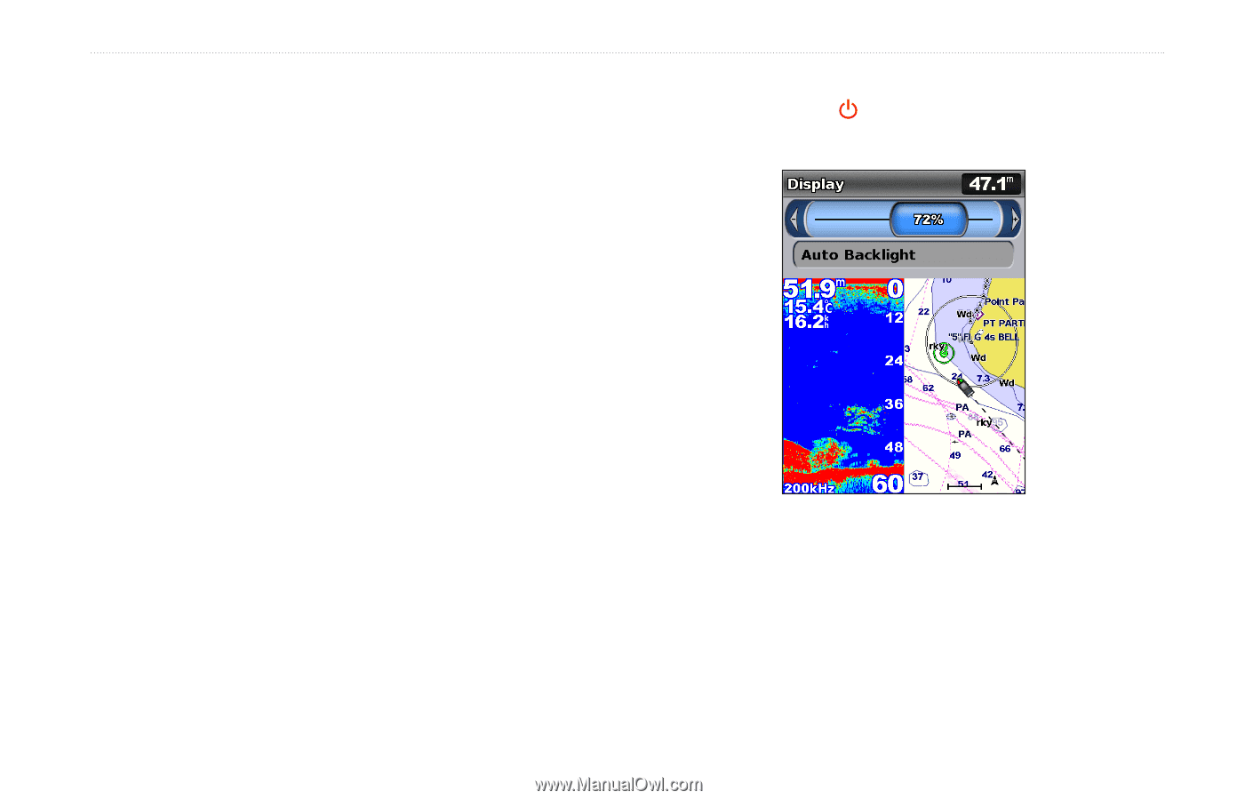
Adjusting the Backlight, AIS Alarm Time
 |
View all Garmin GPSMAP 527 manuals
Add to My Manuals
Save this manual to your list of manuals |
Page 9 highlights
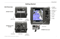
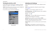
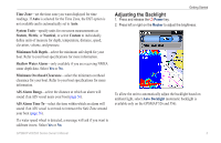
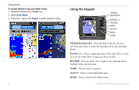
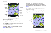
Time Zone-set the time zone you want displayed for time readings. If Auto is selected for the Time Zone, the DST option is not available and is automatically set to Auto. System Units-specify units for on-screen measurements as Statute, Metric, or Nautical, or select Custom to individually define units of measure for depth, temperature, distance, speed, elevation, volume, and pressure. Minimum Safe Depth-select the minimum safe depth for your boat. Refer to your boat specifications for more information. Shallow Water Alarm-only available if you are receiving NMEA sonar depth data. Select Yes or No. Minimum Overhead Clearance-select the minimum overhead clearance for your boat. Refer to your boat specifications for more information. AIS Alarm Range-select the distance at which an alarm will sound if an AIS vessel nears your boat (page 56). AIS Alarm Time To-select the time within which an alarm will sound if an AIS vessel is on track to intersect the Safe Zone around your boat (page 56). If a water speed wheel is detected, a message will ask if you want to calibrate it now. Select Yes or No. GPSMAP 400/500 Series Owner's Manual Getting Started Adjusting the Backlight 1. Press and release the Power key. 2. Press left or right on the Rocker to adjust the brightness. To allow the unit to automatically adjust the backlight based on ambient light, select Auto Backlight (automatic backlight is available only on the GPSMAP 526 and 556). 3
-
 1
1 -
2
-
3
-
 4
4 -
 5
5 -
 6
6 -
 7
7 -
 8
8 -
 9
9 -
 10
10 -
 11
11 -
 12
12 -
 13
13 -
 14
14 -
15
-
16
-
17
-
18
-
19
-
20
-
21
-
22
-
23
-
24
-
25
-
26
-
27
-
28
-
29
-
30
-
31
-
32
-
33
-
34
-
35
-
36
-
37
-
38
-
39
-
40
-
41
-
42
-
43
-
44
-
45
-
46
-
47
-
48
-
49
-
50
-
51
-
52
-
53
-
54
-
55
-
56
-
57
-
58
-
59
-
60
-
61
-
62
-
63
-
64
-
65
-
66
-
67
-
68
-
69
-
70
-
71
-
72
-
73
-
74
-
75
-
76
-
77
-
78
-
79
-
80
-
81
-
82
-
83
-
84
 |
 |