Garmin aera 796 Pilot's Guide - Page 123
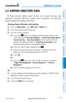
Airport Directory Data, Viewing Airport Directory information
 |
View all Garmin aera 796 manuals
Add to My Manuals
Save this manual to your list of manuals |
Page 123 highlights
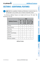
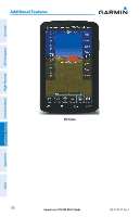
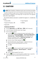
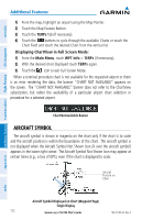
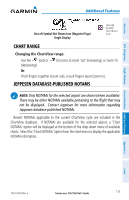
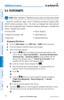
Overview GPS Navigation Flight Planning Hazard Avoidance Additional Features Additional Features 5.2 AIRPORT DIRECTORY DATA The Airport Directory contains airport statistics such as pattern altitudes, noise abatement information, FBO phone numbers, hours of operation, local attractions, ground transportation, lodging, and services. Viewing Airport Directory information: 1) From the Main Menu, touch WPT Info > AOPA Tab. 2) Touch the Waypoint Identifier Button. 3) Enter the desired waypoint: a) Touch the buttons to display the desired search option on the 'Search' Button ('Search by Identifier', 'Search by Facility Name', 'Search by City', 'Search by Address' (only available with the optional City Navigator data), or 'Search by Crossroads' (only available with the optional City Navigator data). b) Touch the 'Search' Button (between the ). c) Enter the desired data using the keypad. If duplicate entries are displayed, touch the desired duplicate from the list. d) Touch OK. Or: a) Touch the buttons to cycle through the waypoint categories ('Flight Plan Waypoints', 'Nearest Airports', or 'Recent Waypoints'). b) Touch the desired waypoint from the list. Or: 1) From the Navigation Map, Weather map, Terrain Map, or VFR/IFR Charts, highlight an airport using the Map Pointer. 2) Touch the Map Feature Button. 3) Touch the AOPA Tab (if necessary). Appendices Index 190-01194-00 Rev. A Garmin aera 795/796 Pilot's Guide 109
-
 1
1 -
2
-
3
-
4
-
5
-
6
-
7
-
8
-
9
-
10
-
11
-
12
-
13
-
14
-
15
-
16
-
17
-
18
-
19
-
20
-
21
-
22
-
23
-
24
-
25
-
26
-
27
-
28
-
29
-
30
-
31
-
32
-
33
-
34
-
35
-
36
-
37
-
38
-
39
-
40
-
41
-
42
-
43
-
44
-
45
-
46
-
47
-
48
-
49
-
50
-
51
-
52
-
53
-
54
-
55
-
56
-
57
-
58
-
59
-
60
-
61
-
62
-
63
-
64
-
65
-
66
-
67
-
68
-
69
-
70
-
71
-
72
-
73
-
74
-
75
-
76
-
77
-
78
-
79
-
80
-
81
-
82
-
83
-
84
-
85
-
86
-
87
-
88
-
89
-
90
-
91
-
92
-
93
-
94
-
95
-
96
-
97
-
98
-
99
-
100
-
101
-
102
-
103
-
104
-
105
-
106
-
107
-
108
-
109
-
110
-
111
-
112
-
113
-
114
-
115
-
116
-
117
-
 118
118 -
 119
119 -
 120
120 -
 121
121 -
 122
122 -
 123
123 -
 124
124 -
 125
125 -
 126
126 -
 127
127 -
 128
128 -
129
-
130
-
131
-
132
-
133
-
134
-
135
-
136
-
137
-
138
-
139
-
140
-
141
-
142
-
143
-
144
-
145
-
146
-
147
-
148
-
149
-
150
-
151
-
152
-
153
-
154
-
155
-
156
-
157
-
158
-
159
-
160
-
161
-
162
-
163
-
164
-
165
-
166
-
167
-
168
-
169
-
170
-
171
-
172
-
173
-
174
-
175
-
176
-
177
-
178
-
179
-
180
-
181
-
182
-
183
-
184
-
185
-
186
-
187
-
188
-
189
-
190
-
191
-
192
-
193
-
194
-
195
-
196
-
197
-
198
-
199
-
200
-
201
-
202
-
203
-
204
-
205
-
206
-
207
-
208
-
209
-
210
 |
 |
