Garmin aera 796 Pilot's Guide - Page 73
CITIES, ARTCC, Select a city, Select an ARTCC
 |
View all Garmin aera 796 manuals
Add to My Manuals
Save this manual to your list of manuals |
Page 73 highlights
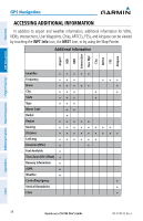
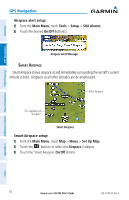
Overview GPS Navigation Flight Planning Hazard Avoidance Additional Features GPS Navigation e) Touch the OK icon. The confirmation window will appear. 3) Touch Yes. CITIES City information can be viewed using the Waypoint Information function, the Nearest function, or the Map Panning function. The Nearest City function can be used to quickly find a city near the aircraft's current position. The list only includes cities that are within 200nm. Select a city: 1) Touch NRST > City. 2) Touch the desired Nearest City from the list. Or: 1) From the Main Menu, touch Map. 2) Touch the desired city symbol on the map. 3) Touch the Map Feature Button with the desired city displayed (refer to the Overview Section on 'Map Panning' for more information). The city information is displayed. ARTCC ARTCC information can be viewed using the Nearest function. The Nearest ARTCC function can be used to quickly find a ARTCC close to the flight path. The list only includes ARTCC that are within 200nm. Select an ARTCC: 1) Touch NRST > ARTCC. 2) Touch the buttons to cycle through the list. The associated bearing, distance, and frequencies are displayed. FSS FSS information can be viewed using the Nearest function. The Nearest FSS function can be used to quickly find a FSS close to the flight path. The list only includes FSS that are within 200nm. Appendices Index 190-01194-00 Rev. A Garmin aera 795/796 Pilot's Guide 59
-
 1
1 -
2
-
3
-
4
-
5
-
6
-
7
-
8
-
9
-
10
-
11
-
12
-
13
-
14
-
15
-
16
-
17
-
18
-
19
-
20
-
21
-
22
-
23
-
24
-
25
-
26
-
27
-
28
-
29
-
30
-
31
-
32
-
33
-
34
-
35
-
36
-
37
-
38
-
39
-
40
-
41
-
42
-
43
-
44
-
45
-
46
-
47
-
48
-
49
-
50
-
51
-
52
-
53
-
54
-
55
-
56
-
57
-
58
-
59
-
60
-
61
-
62
-
63
-
64
-
65
-
66
-
67
-
 68
68 -
 69
69 -
 70
70 -
 71
71 -
 72
72 -
 73
73 -
 74
74 -
 75
75 -
 76
76 -
 77
77 -
 78
78 -
79
-
80
-
81
-
82
-
83
-
84
-
85
-
86
-
87
-
88
-
89
-
90
-
91
-
92
-
93
-
94
-
95
-
96
-
97
-
98
-
99
-
100
-
101
-
102
-
103
-
104
-
105
-
106
-
107
-
108
-
109
-
110
-
111
-
112
-
113
-
114
-
115
-
116
-
117
-
118
-
119
-
120
-
121
-
122
-
123
-
124
-
125
-
126
-
127
-
128
-
129
-
130
-
131
-
132
-
133
-
134
-
135
-
136
-
137
-
138
-
139
-
140
-
141
-
142
-
143
-
144
-
145
-
146
-
147
-
148
-
149
-
150
-
151
-
152
-
153
-
154
-
155
-
156
-
157
-
158
-
159
-
160
-
161
-
162
-
163
-
164
-
165
-
166
-
167
-
168
-
169
-
170
-
171
-
172
-
173
-
174
-
175
-
176
-
177
-
178
-
179
-
180
-
181
-
182
-
183
-
184
-
185
-
186
-
187
-
188
-
189
-
190
-
191
-
192
-
193
-
194
-
195
-
196
-
197
-
198
-
199
-
200
-
201
-
202
-
203
-
204
-
205
-
206
-
207
-
208
-
209
-
210
 |
 |
