Garmin aera 796 Pilot's Guide - Page 56
Map Display Setup
 |
View all Garmin aera 796 manuals
Add to My Manuals
Save this manual to your list of manuals |
Page 56 highlights
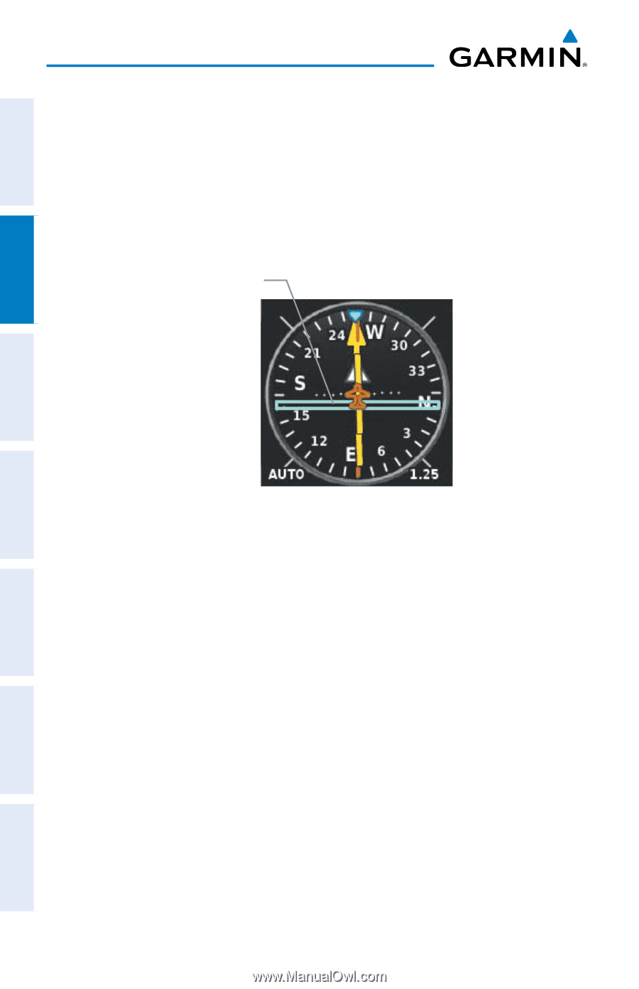
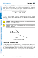
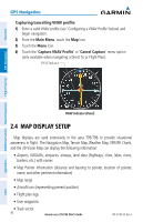
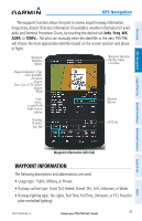
Overview GPS Navigation Capturing/cancelling VNAV profile: 1) Enter a valid VNAV profile (see 'Configuring a VNAV Profile' below) and begin navigation. 2) From the Main Menu, touch the Map Icon. 3) Touch the Menu Icon 4) Touch the 'Capture VNAV Profile' or 'Cancel Capture' menu option (only available when navigating a Direct To or Flight Plan). VNAV Indicator GPS Navigation Additional Features Hazard Avoidance Flight Planning Appendices VNAV Indicator (Panel) 2.4 MAP DISPLAY SETUP Map displays are used extensively in the aera 795/796 to provide situational awareness in flight. The Navigation Map, Terrain Map, Weather Map, VFR/IFR Charts, and the 3D Vision Map can display the following information: • Airports, NAVAIDs, airspaces, airways, land data (highways, cities, lakes, rivers, borders, etc.) with names • Map Pointer information (distance and bearing to pointer, location of pointer, name, and other pertinent information) • Map range • Aircraft icon (representing present position) • Flight plan legs • User waypoints • Track vector 42 Garmin aera 795/796 Pilot's Guide 190-01194-00 Rev. A Index
-
 1
1 -
2
-
3
-
4
-
5
-
6
-
7
-
8
-
9
-
10
-
11
-
12
-
13
-
14
-
15
-
16
-
17
-
18
-
19
-
20
-
21
-
22
-
23
-
24
-
25
-
26
-
27
-
28
-
29
-
30
-
31
-
32
-
33
-
34
-
35
-
36
-
37
-
38
-
39
-
40
-
41
-
42
-
43
-
44
-
45
-
46
-
47
-
48
-
49
-
50
-
 51
51 -
 52
52 -
 53
53 -
 54
54 -
 55
55 -
 56
56 -
 57
57 -
 58
58 -
 59
59 -
 60
60 -
 61
61 -
62
-
63
-
64
-
65
-
66
-
67
-
68
-
69
-
70
-
71
-
72
-
73
-
74
-
75
-
76
-
77
-
78
-
79
-
80
-
81
-
82
-
83
-
84
-
85
-
86
-
87
-
88
-
89
-
90
-
91
-
92
-
93
-
94
-
95
-
96
-
97
-
98
-
99
-
100
-
101
-
102
-
103
-
104
-
105
-
106
-
107
-
108
-
109
-
110
-
111
-
112
-
113
-
114
-
115
-
116
-
117
-
118
-
119
-
120
-
121
-
122
-
123
-
124
-
125
-
126
-
127
-
128
-
129
-
130
-
131
-
132
-
133
-
134
-
135
-
136
-
137
-
138
-
139
-
140
-
141
-
142
-
143
-
144
-
145
-
146
-
147
-
148
-
149
-
150
-
151
-
152
-
153
-
154
-
155
-
156
-
157
-
158
-
159
-
160
-
161
-
162
-
163
-
164
-
165
-
166
-
167
-
168
-
169
-
170
-
171
-
172
-
173
-
174
-
175
-
176
-
177
-
178
-
179
-
180
-
181
-
182
-
183
-
184
-
185
-
186
-
187
-
188
-
189
-
190
-
191
-
192
-
193
-
194
-
195
-
196
-
197
-
198
-
199
-
200
-
201
-
202
-
203
-
204
-
205
-
206
-
207
-
208
-
209
-
210
 |
 |