Garmin aera 796 Pilot's Guide - Page 54
Using the VNAV Feature, from the HSI.
 |
View all Garmin aera 796 manuals
Add to My Manuals
Save this manual to your list of manuals |
Page 54 highlights
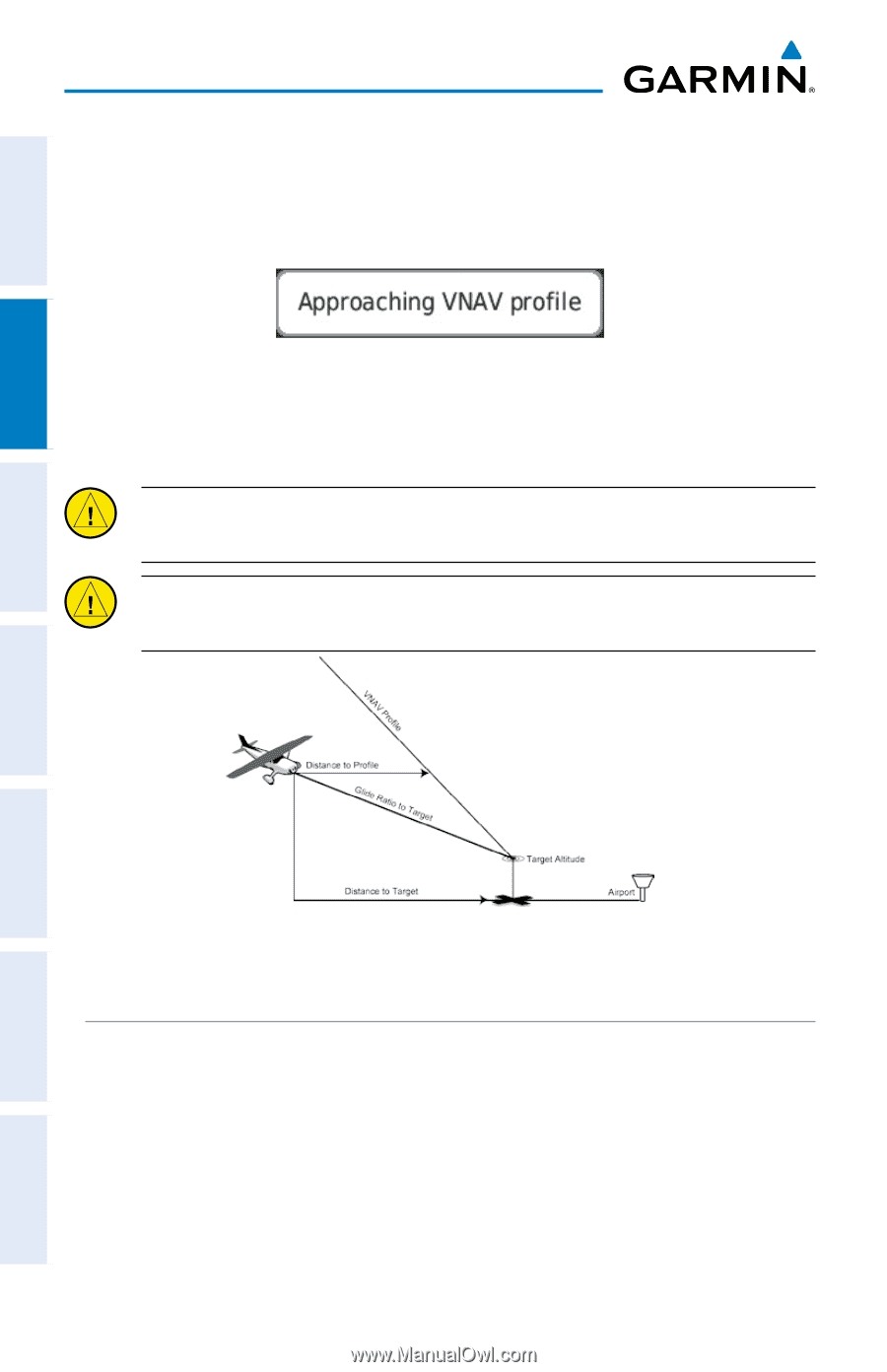
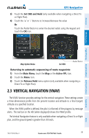
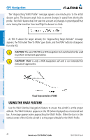
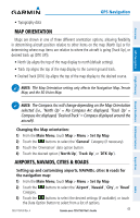
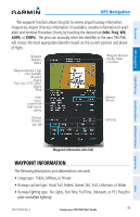
Overview GPS Navigation GPS Navigation The "Approaching VNAV Profile" message appears one minute prior to the initial descent point. The descent angle locks to prevent changes in speed from altering the profile. The VNAV feature does not take into account any changes in groundspeed that occur during the transition from level flight to descent or climb. At 500 ft above the target altitude, the "Approaching Target Altitude" message appears, the 'Estimated Time To VNAV' goes blank, and the VNAV indicator disappears from the HSI. CAUTION: The aera 795/796 is a VFR navigation tool and should not be used to perform instrument approaches. CAUTION: VNAV is only a VFR navigation aid and is not intended for instrument approaches. Additional Features Hazard Avoidance Flight Planning Appendices Visual Representation of VNAV USING THE VNAV FEATURE Use the VNAV (Vertical Navigation) feature to ensure the aircraft is at the proper altitude. The VNAV Indicator appears on the HSI (when displayed) as a horizontal teal bar. A message appears when approaching the VNAV Profile. When the bar is in the vertical center of the HSI, the aircraft is at the proper altitude for the VNAV Profile. 40 Garmin aera 795/796 Pilot's Guide 190-01194-00 Rev. A Index
-
 1
1 -
2
-
3
-
4
-
5
-
6
-
7
-
8
-
9
-
10
-
11
-
12
-
13
-
14
-
15
-
16
-
17
-
18
-
19
-
20
-
21
-
22
-
23
-
24
-
25
-
26
-
27
-
28
-
29
-
30
-
31
-
32
-
33
-
34
-
35
-
36
-
37
-
38
-
39
-
40
-
41
-
42
-
43
-
44
-
45
-
46
-
47
-
48
-
 49
49 -
 50
50 -
 51
51 -
 52
52 -
 53
53 -
 54
54 -
 55
55 -
 56
56 -
 57
57 -
 58
58 -
 59
59 -
60
-
61
-
62
-
63
-
64
-
65
-
66
-
67
-
68
-
69
-
70
-
71
-
72
-
73
-
74
-
75
-
76
-
77
-
78
-
79
-
80
-
81
-
82
-
83
-
84
-
85
-
86
-
87
-
88
-
89
-
90
-
91
-
92
-
93
-
94
-
95
-
96
-
97
-
98
-
99
-
100
-
101
-
102
-
103
-
104
-
105
-
106
-
107
-
108
-
109
-
110
-
111
-
112
-
113
-
114
-
115
-
116
-
117
-
118
-
119
-
120
-
121
-
122
-
123
-
124
-
125
-
126
-
127
-
128
-
129
-
130
-
131
-
132
-
133
-
134
-
135
-
136
-
137
-
138
-
139
-
140
-
141
-
142
-
143
-
144
-
145
-
146
-
147
-
148
-
149
-
150
-
151
-
152
-
153
-
154
-
155
-
156
-
157
-
158
-
159
-
160
-
161
-
162
-
163
-
164
-
165
-
166
-
167
-
168
-
169
-
170
-
171
-
172
-
173
-
174
-
175
-
176
-
177
-
178
-
179
-
180
-
181
-
182
-
183
-
184
-
185
-
186
-
187
-
188
-
189
-
190
-
191
-
192
-
193
-
194
-
195
-
196
-
197
-
198
-
199
-
200
-
201
-
202
-
203
-
204
-
205
-
206
-
207
-
208
-
209
-
210
 |
 |