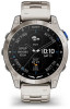
Garmin D2 Mach 1 Owners Manual PDF - Page 13
Viewing NEXRAD Weather Radar, Viewing PLANESYNC, Flying Activity
 |
View all Garmin D2 Mach 1 manuals
Add to My Manuals
Save this manual to your list of manuals |
Page 13 highlights
3 Select TAF. Airport identifier Aviation flight category Age of the data and when the report was issued Viewing PLANESYNC™ Data WARNING This watch is not intended to provide primary flight information and is to be used for supplemental purposes only. When you connect your watch, a compatible GDL® 60 portable receiver, and an aircraft to your flyGarmin.com account, you can view avionics data on your watch. Go to buy.garmin.com for more information about compatible devices. 1 From the watch face, press UP or DOWN to view the PLANESYNC glance. 2 Press START. Time period covered in the report Wind direction, speed, and gusts Height of the base of the lowest clouds and visi bility in statute miles Weather conditions 4 Press DOWN to view reports for later times. Viewing NEXRAD Weather Radar Before you can view NEXRAD weather radar, you must pair your device with your smartphone (Pairing Your Phone, page 64). You can view the weather radar image associated with your current location. NOTE: You can customize the NEXRAD Tiles option in the Aviation settings to download additional weather radar images based on a direction from your current location (Aviation Settings, page 8). 1 At any time, hold DOWN and START at the same time. The device downloads a square of radar data for your current GPS position, outlined in magenta. The radar data is active for 5 minutes. NOTE: If you are near the border of the square, you may not see all applicable radar data. 2 If necessary, hold DOWN and START to download new data. 3 If this is the first time you are viewing the glance, select Select Aircraft to connect to an aircraft in your flyGarmin.com account. 4 Select an option: • Press DOWN to view the aircraft status, location, and sensor data. • Press START, and select Remote Status to refresh the connection to the aircraft. • Press START, and select Select Aircraft to connect to a different aircraft. Flying Activity A flying activity starts automatically when your detected climb rate exceeds the value you set in the auto fly settings. The default auto fly value is 500 fpm. Starting a Flight 1 From the watch face, press START. 2 Select Fly. 3 Go outside and wait while the watch locates satellites. 4 Press START to start the flight timer. NOTE: Your activity data is recorded only while the flight timer is running. You can edit the activity settings to start the Fly activity and the flight timer automatically at specified thresholds (Activities and App Settings, page 24). Flying 5
-
 1
1 -
2
-
3
-
4
-
5
-
6
-
7
-
 8
8 -
 9
9 -
 10
10 -
 11
11 -
 12
12 -
 13
13 -
 14
14 -
 15
15 -
 16
16 -
 17
17 -
 18
18 -
19
-
20
-
21
-
22
-
23
-
24
-
25
-
26
-
27
-
28
-
29
-
30
-
31
-
32
-
33
-
34
-
35
-
36
-
37
-
38
-
39
-
40
-
41
-
42
-
43
-
44
-
45
-
46
-
47
-
48
-
49
-
50
-
51
-
52
-
53
-
54
-
55
-
56
-
57
-
58
-
59
-
60
-
61
-
62
-
63
-
64
-
65
-
66
-
67
-
68
-
69
-
70
-
71
-
72
-
73
-
74
-
75
-
76
-
77
-
78
-
79
-
80
-
81
-
82
-
83
-
84
-
85
-
86
-
87
-
88
-
89
-
90
-
91
-
92
-
93
-
94
-
95
-
96
-
97
-
98
-
99
-
100
-
101
-
102
-
103
-
104
 |
 |
