Garmin D2 Mach 1 Owners Manual PDF - Page 15
Routes and Flight Plans
 |
View all Garmin D2 Mach 1 manuals
Add to My Manuals
Save this manual to your list of manuals |
Page 15 highlights
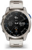
Viewing Waypoint Information You can view information about a location from the list of nearest airports, list of navigational aids, or list of aviation waypoints. 1 Find a waypoint (Finding a Waypoint, page 7). 2 Select an option: NOTE: Options vary by the selected waypoint type. • To navigate directly to the selected location, select Direct-To. • To download the NEXRAD weather radar image associated with the selected location, select NEXRAD (Viewing NEXRAD Weather Radar, page 5). • To show the waypoint on the map, select Show Map. • To view METAR, TAF, and MOS information, select Airport Info and select the airport. NOTE: MOS information is available for United States airports only. • To show radio frequencies, select Airport Info > Frequencies. • To show runway information, such as the runway length and surface material, select Airport Info > Runway Info. • To view general information, such as the distance and bearing from your current location, select General Info or Airport Info > Airport Info. • To show weather information, select Weather. Horizontal Situation Indicator WARNING This watch is not intended to provide primary flight information and is to be used for supplemental purposes only. Airport identifier and distance to the current desti nation. Course deviation indicator (CDI). Indicates the location of the desired course line in relation to your location. To-and-from indicator. Indicates whether you are headed toward or away from the waypoint. Configurable course deviation distance scale. Course deviation distance. The dots indicate your distance off course. Bearing to the nearest airport. Estimated time en route (ETE). Routes and Flight Plans A route is a sequence of waypoints or locations that leads you to your final destination. Flight plans are routes that use direct routing optimized for aviation. You can create flight plans on your watch or by using the Garmin Pilot™ app for mobile devices. Finding a Waypoint 1 From the watch face, press START. 2 Select Fly. 3 Hold MENU. 4 Select Navigation > Flight Planning > Find Waypoint. 5 Select an option: • To find a waypoint by name, select Search by Ident.. • To select from a list of the nearest airports, select Nearest Airports. • To select from a list of the nearest navigational aids, select Nearest Navaids. • To select from a list of the nearest intersections, select Nearest Intersection. 6 Select a location. 7 If necessary, select an option to view additional waypoint details (Viewing Waypoint Information, page 7). Creating a Flight Plan on Your Watch 1 From the watch face, press START. 2 Select Fly. 3 Hold MENU. 4 Select Navigation > Flight Planning > Saved Plans > Create New. 5 Enter the name of the flight plan. 6 Select . 7 Select Add Location. 8 Select a location type. 9 Select the first point on the route. 10 Repeat steps 7 through 9 until the route is complete. 11 Select Done to save the route. Following a Flight Plan 1 From the watch face, press START. 2 Select Fly. 3 Hold MENU. 4 Select Navigation > Flight Planning > Saved Plans. 5 Select a flight plan. 6 Select Set Active to begin following the flight plan. Flying 7
-
 1
1 -
2
-
3
-
4
-
5
-
6
-
7
-
8
-
9
-
 10
10 -
 11
11 -
 12
12 -
 13
13 -
 14
14 -
 15
15 -
 16
16 -
 17
17 -
 18
18 -
 19
19 -
 20
20 -
21
-
22
-
23
-
24
-
25
-
26
-
27
-
28
-
29
-
30
-
31
-
32
-
33
-
34
-
35
-
36
-
37
-
38
-
39
-
40
-
41
-
42
-
43
-
44
-
45
-
46
-
47
-
48
-
49
-
50
-
51
-
52
-
53
-
54
-
55
-
56
-
57
-
58
-
59
-
60
-
61
-
62
-
63
-
64
-
65
-
66
-
67
-
68
-
69
-
70
-
71
-
72
-
73
-
74
-
75
-
76
-
77
-
78
-
79
-
80
-
81
-
82
-
83
-
84
-
85
-
86
-
87
-
88
-
89
-
90
-
91
-
92
-
93
-
94
-
95
-
96
-
97
-
98
-
99
-
100
-
101
-
102
-
103
-
104
 |
 |
