Garmin D2 Mach 1 Owners Manual PDF - Page 14
Direct-To, START, Search by Ident., Stop Navigation, LIGHT
 |
View all Garmin D2 Mach 1 manuals
Add to My Manuals
Save this manual to your list of manuals |
Page 14 highlights
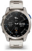
5 Start your activity. 6 After you complete your activity, press STOP, and select Save. Viewing Your SpO2 Readings in Flight WARNING The SpO2 readings are intended for supplemental information only. Always defer to applicable flight instruments for primary awareness. The watch has a wrist-based pulse oximeter to gauge the saturation of oxygen in your blood (SpO2). During a flight, the watch automatically takes pulse oximeter readings more frequently, so you can monitor your SpO2 percentage. TIP: You can improve the accuracy of your SpO2 readings by turning on the All Day pulse oximeter mode (Setting the Pulse Oximeter Mode, page 54). During a flight, scroll up or down to view the SpO2 data screen. Your most recent reading appears as an oxygen saturation percentage and position on the color gauge. NOTE: If you are too active for the watch to determine your oxygen saturation, dashes appear instead of a percentage. You should remain stationary for up to 30 seconds while the watch reads your blood oxygen saturation. Navigating to the Nearest Airport 1 Hold BACK·LAP. A list of the nearest airports appears. Nearest airport identifier Distance to the nearest airport Bearing and pointer to the nearest airport Flight condition from the nearest METAR station 2 Select an airport. 6 3 Select Direct-To. 4 Press START to begin navigation. Navigating to an Aviation Waypoint by Its Identifier You can navigate directly to an aviation waypoint by searching for an alphanumeric identifier. 1 Hold . 2 Select Search by Ident.. 3 Enter all or part of the alphanumeric identifier. 4 Select . A list of matching waypoints appears. 5 Select the waypoint. 6 Press START to begin navigation. Stopping Navigation Hold MENU, and select Stop Navigation. Enabling Emergency Mode WARNING This feature is only designed for use in the unlikely event of a full aircraft system failure. Do not use this feature as a primary means of navigation. This feature is for informational purposes only and does not engage your aircraft's autopilot when activated or otherwise operate your aircraft. You are still responsible for the safe and prudent operation of your aircraft. When activated, this feature provides guidance to the nearest airport. Such guidance is for informational purposes only and does not guarantee that the airport provided is suitable for the landing of your aircraft. You must still use good piloting judgment in safely operating and landing your aircraft. You can activate emergency mode on your watch to see the direction to your nearest airport and glide information. 1 Hold until your nearest airport appears. 2 Press UP or DOWN to scroll through other nearby airports. 3 Press LIGHT to view the airport information. 4 Follow the pointer to the airport. NOTE: When you are within 10 degrees of the correct track, the pointer turns green. 5 If necessary, pair your watch with your inReach® device (Using the inReach Remote, page 59). 6 Hold START to initiate an SOS rescue with your inReach device. The SOS countdown begins, and the inReach device sends a default message to the Garmin® International Emergency Response Coordination Center (IERCC) with details about your location. NOTE: You can use the inReach device to reply to the IERCC. You can hold START on your watch to cancel the SOS request. See the owner's manual for your inReach device for more information. 7 Press BACK to stop the activity. Flying
-
 1
1 -
2
-
3
-
4
-
5
-
6
-
7
-
8
-
 9
9 -
 10
10 -
 11
11 -
 12
12 -
 13
13 -
 14
14 -
 15
15 -
 16
16 -
 17
17 -
 18
18 -
 19
19 -
20
-
21
-
22
-
23
-
24
-
25
-
26
-
27
-
28
-
29
-
30
-
31
-
32
-
33
-
34
-
35
-
36
-
37
-
38
-
39
-
40
-
41
-
42
-
43
-
44
-
45
-
46
-
47
-
48
-
49
-
50
-
51
-
52
-
53
-
54
-
55
-
56
-
57
-
58
-
59
-
60
-
61
-
62
-
63
-
64
-
65
-
66
-
67
-
68
-
69
-
70
-
71
-
72
-
73
-
74
-
75
-
76
-
77
-
78
-
79
-
80
-
81
-
82
-
83
-
84
-
85
-
86
-
87
-
88
-
89
-
90
-
91
-
92
-
93
-
94
-
95
-
96
-
97
-
98
-
99
-
100
-
101
-
102
-
103
-
104
 |
 |
