Garmin GPSMAP 60CSx Owner's Manual - Page 55
Use the Map Setup, Small, Medium, Large, ROCKER, ENTER, Marine Colors, Spot Soundings, Light Sectors
 |
UPC - 753759049126
View all Garmin GPSMAP 60CSx manuals
Add to My Manuals
Save this manual to your list of manuals |
Page 55 highlights
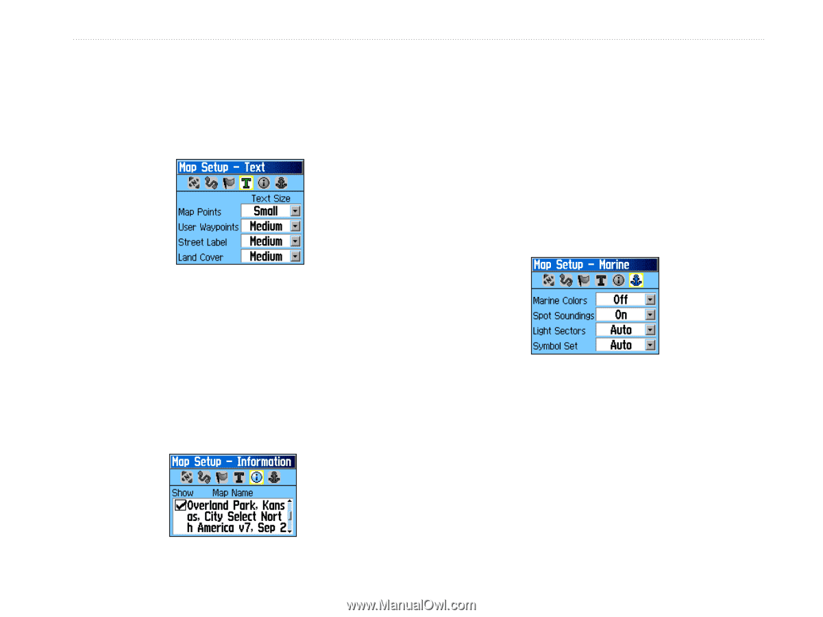
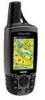
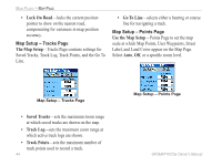
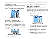
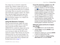
Map Setup - Text Page Use the Map Setup - Text Page to select the text size for descriptions of map items on the Map Page. You can select from None, Small, Medium, or Large. Map Setup - Text Page Main Pages > Map Page Press MENU to view options for showing maps. Map Setup - Marine Page Use the Map Setup - Marine Page to customize settings for marine colors, spot soundings, light sectors, and symbol sets when using downloaded marine charts (MapSource BlueChart marine mapping data). • Marine Colors-toggles marine colors on or off on the Map Page. Map Setup - Information Page The Map Setup - Information Page shows a list of downloaded detailed MapSource maps such as topographic, marine charts, and other maps with autorouting capability. Use the ROCKER to highlight a map, and press ENTER to show it on the map display or turn it off. Map Setup - Marine Page • Spot Soundings-toggles spot soundings on or off on the Map Page (depth measurements shown on the map). • Light Sectors-select Off, Auto, or ON (Navigational light locations). Map Setup - Information Page • Symbol Set-select the symbol set to use (Auto, GARMIN, NOAA, International). GPSMAP 60CSx Owner's Manual 45
-
 1
1 -
2
-
3
-
4
-
5
-
6
-
7
-
8
-
9
-
10
-
11
-
12
-
13
-
14
-
15
-
16
-
17
-
18
-
19
-
20
-
21
-
22
-
23
-
24
-
25
-
26
-
27
-
28
-
29
-
30
-
31
-
32
-
33
-
34
-
35
-
36
-
37
-
38
-
39
-
40
-
41
-
42
-
43
-
44
-
45
-
46
-
47
-
48
-
49
-
 50
50 -
 51
51 -
 52
52 -
 53
53 -
 54
54 -
 55
55 -
 56
56 -
 57
57 -
 58
58 -
 59
59 -
 60
60 -
61
-
62
-
63
-
64
-
65
-
66
-
67
-
68
-
69
-
70
-
71
-
72
-
73
-
74
-
75
-
76
-
77
-
78
-
79
-
80
-
81
-
82
-
83
-
84
-
85
-
86
-
87
-
88
-
89
-
90
-
91
-
92
-
93
-
94
-
95
-
96
-
97
-
98
-
99
-
100
-
101
-
102
-
103
-
104
-
105
-
106
-
107
-
108
-
109
-
110
-
111
-
112
-
113
-
114
-
115
-
116
 |
 |