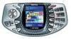
Nokia N-GAGE User Guide - Page 72
Nokia Maps, About Maps, Network positioning, Compass, Use the mobile network for positioning - software download
 |
UPC - 758478517055
View all Nokia N-GAGE manuals
Add to My Manuals
Save this manual to your list of manuals |
Page 72 highlights
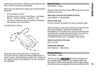
Nokia Maps Nokia Maps About Maps With Maps, you can see your current location on the map, browse maps of different cities and countries, search for places, plan routes from one location to another, save locations, and send them to compatible devices. You can also purchase licences for traffic information and navigation services, if available for your country or region. When you use Maps for the first time, you may need to select an internet access point for downloading maps. If you browse to an area which is not covered by maps already downloaded in your device, a map for the area is automatically downloaded through the internet. Some maps may be available in your device or on a memory card. You can also use the Nokia Map Loader PC software to download maps. To install Nokia Map Loader to a compatible PC, see www.nokia.com/maps. Tip: To avoid data transfer costs, you can also use Maps without an internet connection, and browse the maps that are saved in your device or memory card. Network positioning You can use the mobile network to find your current location. This is faster but less accurate than with GPS, and you cannot use the location as a starting point for navigation. Select Menu > Maps. Use the mobile network for positioning Select the network-based positioning method from the device settings. When you start the Maps application and your GPS connection is ready, GPS replaces mobile network as the positioning method. Compass Select Menu > Maps. Your device has an internal compass. When the compass is enabled, the circle around the compass is green, and the map view rotates automatically according to the direction to which the top of the device is pointing. Note: Downloading content such as maps, satellite images, voice files, guides or traffic information may involve transmission of large amounts of data (network service). The compass has limited accuracy. Electromagnetic fields, metal objects, or other external circumstances may also affect the accuracy of the compass. The compass should always be properly calibrated. Almost all digital cartography is inaccurate and incomplete to some extent. Never rely solely on the cartography that you download for use in this device. 72 The compass is active by default. To turn off the compass, in the Maps main view, select Options > Tools > Turn compass off. When the compass is not turned on, the circle around the compass is white, and the map view does not rotate automatically. Turning off the compass is only
-
 1
1 -
2
-
3
-
4
-
5
-
6
-
7
-
8
-
9
-
10
-
11
-
12
-
13
-
14
-
15
-
16
-
17
-
18
-
19
-
20
-
21
-
22
-
23
-
24
-
25
-
26
-
27
-
28
-
29
-
30
-
31
-
32
-
33
-
34
-
35
-
36
-
37
-
38
-
39
-
40
-
41
-
42
-
43
-
44
-
45
-
46
-
47
-
48
-
49
-
50
-
51
-
52
-
53
-
54
-
55
-
56
-
57
-
58
-
59
-
60
-
61
-
62
-
63
-
64
-
65
-
66
-
 67
67 -
 68
68 -
 69
69 -
 70
70 -
 71
71 -
 72
72 -
 73
73 -
 74
74 -
 75
75 -
 76
76 -
 77
77 -
78
-
79
-
80
-
81
-
82
-
83
-
84
-
85
-
86
-
87
-
88
-
89
-
90
-
91
-
92
-
93
-
94
-
95
-
96
-
97
-
98
-
99
-
100
-
101
-
102
-
103
-
104
-
105
-
106
-
107
-
108
-
109
-
110
-
111
-
112
-
113
-
114
-
115
-
116
-
117
-
118
-
119
-
120
-
121
-
122
-
123
-
124
-
125
-
126
-
127
-
128
-
129
-
130
-
131
-
132
-
133
-
134
-
135
-
136
-
137
-
138
-
139
-
140
-
141
-
142
-
143
-
144
-
145
-
146
-
147
-
148
-
149
-
150
-
151
-
152
-
153
-
154
-
155
-
156
-
157
-
158
-
159
 |
 |