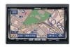
Panasonic CN-NVD905U Navigation Dvd Player - Page 110
What is a navigation system
 |
UPC - 037988757947
View all Panasonic CN-NVD905U manuals
Add to My Manuals
Save this manual to your list of manuals |
Page 110 highlights
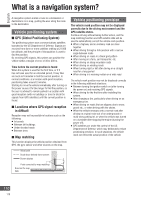
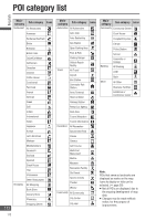
English What is a navigation system? A navigation system marks a route to a destination or destinations on a map, guiding the user along the route to the destination. Vehicle positioning system GPS (Global Positioning System) The positioning system uses communications satellites launched by the US Department of Defense. Signals are received from three or more satellites orbiting at 21 000 km altitude, and the principle of triangulation is used to find the position. By receiving GPS signals, this system can position the vehicle within a margin of error of 30 to 200 m. Time before the current position is found When this system is used for the first time, or if it has not been used for an extended period, it may take as much as 5 minutes to find the current position. In normal conditions, at a location with good reception, positioning takes around 2 minutes. Starting to move the vehicle immediately after turning on the power causes it to take longer to find the position, so the user is advised to remain parked in a location with good reception (with no buildings or trees to block the signals from GPS satellites) until the current position is found. Locations where GPS signal reception is difficult Reception may not be possible in locations such as the following: In tunnels Between tall buildings Under elevated roads Between trees Map matching This function displays the vehicle position obtained from GPS, the gyro sensor and other sources on the map. Vehicle positioning precision The vehicle mark position may not be displayed correctly due to the driving environment and the GPS satellite status. Continue driving without taking further action, and the map matching function and GPS satellite data will be used to automatically correct the vehicle mark position. When a highway and an ordinary road are close together When driving through a fork junction with a narrow angle between roads When driving on roads in a block grid pattern After moving on a ferry, car transporter, etc. When driving on steep mountain roads When driving on winding roads When turning right or left after driving on a straight road for a long period When driving in a weaving motion on a wide road The vehicle mark position may not be displayed correctly in the following additional situations: Between turning the ignition switch on (after turning the power on) and receiving GPS signals. When driving for the first time after installing this system. After changing a tire, particularly when driving on an emergency tire. When driving on roads that are slippery due to snow, gravel etc., or when driving with tire chains. When the vehicle emerges onto a normal road after driving on a spiral route out of an underground or multi-story parking lot, or when the vehicle was turned on a turntable after stopping the engine (turning the power off). GPS satellites are under the control of the US Department of Defense, which may deliberately reduce positioning precision. In such situations, the vehicle mark not reflect the actual position of the vehicle. Actual path Route trace derived from sensors Screen display Point corrected by map matching Road on the map data 110 110
-
 1
1 -
2
-
3
-
4
-
5
-
6
-
7
-
8
-
9
-
10
-
11
-
12
-
13
-
14
-
15
-
16
-
17
-
18
-
19
-
20
-
21
-
22
-
23
-
24
-
25
-
26
-
27
-
28
-
29
-
30
-
31
-
32
-
33
-
34
-
35
-
36
-
37
-
38
-
39
-
40
-
41
-
42
-
43
-
44
-
45
-
46
-
47
-
48
-
49
-
50
-
51
-
52
-
53
-
54
-
55
-
56
-
57
-
58
-
59
-
60
-
61
-
62
-
63
-
64
-
65
-
66
-
67
-
68
-
69
-
70
-
71
-
72
-
73
-
74
-
75
-
76
-
77
-
78
-
79
-
80
-
81
-
82
-
83
-
84
-
85
-
86
-
87
-
88
-
89
-
90
-
91
-
92
-
93
-
94
-
95
-
96
-
97
-
98
-
99
-
100
-
101
-
102
-
103
-
104
-
 105
105 -
 106
106 -
 107
107 -
 108
108 -
 109
109 -
 110
110 -
 111
111 -
 112
112 -
 113
113 -
 114
114 -
 115
115 -
116
-
117
-
118
 |
 |
