Audiovox NVX430BT User Manual - Page 23
Streets and roads, Other objects
 |
View all Audiovox NVX430BT manuals
Add to My Manuals
Save this manual to your list of manuals |
Page 23 highlights
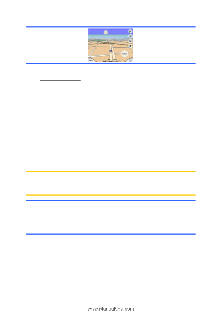
4.4.4 Streets and roads The similarity of The NVX430BT Navigator to paper roadmaps is also convenient when it comes to streets, the most important elements of the map concerning navigation. The NVX430BT Navigator uses similar color codes to those you are accustomed to, and the width of the streets also refers to their importance, so it will not be difficult to tell a highway from a small street. Streets and roads have names or numbers for identification. Of course, this information can be displayed on the map. The NVX430BT Navigator uses two different ways to show street labels. The conventional way is the same as a roadmap - it displays the name of the street aligned with the street. The alternative is a kind of virtual signpost stuck into the street itself. You need not choose between the two modes. The NVX430BT Navigator will use the one best for the current tilt and zoom level. Zoom in to have only a few streets on the map, and start tilting up and down to see how The NVX430BT Navigator switches between the two modes in an instant. Note: The automatic switching is on even when using Smart Zoom. At first you may find it odd, but later you will discover how it adjusts the displayed information to the current view of the map. It is important, as the driver must be able to read the map at a glance. Tip: If you do not want to be bothered by street names during navigation, turn them off on the Map Settings screen (5.2.4). Tip: Major roads usually have alternative names (numbering) besides the primary name. You can choose whether to display these alternative names or not. You can set this in Map settings (5.2.3). 4.4.5 Other objects To help orientate you, the map also contains objects that have no other navigating function than to help you recognize your location on the map. These are surfacewaters, large buildings, forests, etc. 23
-
 1
1 -
2
-
3
-
4
-
5
-
6
-
7
-
8
-
9
-
10
-
11
-
12
-
13
-
14
-
15
-
16
-
17
-
 18
18 -
 19
19 -
 20
20 -
 21
21 -
 22
22 -
 23
23 -
 24
24 -
 25
25 -
 26
26 -
 27
27 -
 28
28 -
29
-
30
-
31
-
32
-
33
-
34
-
35
-
36
-
37
-
38
-
39
-
40
-
41
-
42
-
43
-
44
-
45
-
46
-
47
-
48
-
49
-
50
-
51
-
52
-
53
-
54
-
55
-
56
-
57
-
58
-
59
-
60
-
61
-
62
-
63
-
64
-
65
-
66
-
67
-
68
-
69
-
70
-
71
-
72
-
73
-
74
-
75
-
76
-
77
-
78
-
79
-
80
-
81
-
82
-
83
-
84
-
85
-
86
-
87
-
88
-
89
 |
 |