Garmin G500 Pilots Guide - Page 199
Weather Mode, Color, Approximate, Intensity, Rainfall Rate, in/hr
 |
View all Garmin G500 manuals
Add to My Manuals
Save this manual to your list of manuals |
Page 199 highlights
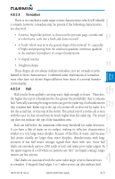
Foreword Sec 1 System Sec 2 PFD Sec 3 MFD Sec 4 Hazard Avoidance Features Sec 5 Additional Weather Mode Color Black Green Yellow Red Magenta Approximate Intensity < 23 dBZ 23 dBZ to < 32 dBZ 32 dBZ to < 41 dBZ 41 dBZ to < 50 dBZ 50 dBZ and greater Approximate Rainfall Rate (in/hr) < .01 .01 - 0.1 0.1 - 0.5 0.5 - 2 > 2 Table 4-17 Precipitation Intensity Levels 4.8.5.2 Thunderstorms Updrafts and downdrafts in thunderstorms carry water through the cloud. The more severe the drafts, the greater the number and size of the precipitation droplets. With this in mind, the following interpretations can be made from what is displayed on the weather radar. Avoid these areas by an extra wide margin. • In areas where the displayed target intensity is red or magenta (indicating large amounts of precipitation), the turbulence is considered severe. • Areas that show steep color gradients (intense color changes) over thin bands or short distances suggest irregular rainfall rate and strong turbulence. • Areas that show red or magenta are associated with hail or turbulence, as well as heavy precipitation. Vertical scanning and antenna tilt management may be necessary to identify areas of maximum intensity. Along squall lines (multiple cells or clusters of cells in a line), individual cells may be in different stages of development. Areas between closely spaced, intense targets may contain developing clouds not having enough moisture to produce a return. However, these areas could have strong updrafts or downdrafts. Targets showing wide areas of green are generally precipitation without severe turbulence. Irregularities in the target return may also indicate turbulence, appearing as "hooks," "fingers," or "scalloped" edges. These irregularities may be present in green areas with no yellow, red, or magenta areas and should be treated as highly dangerous areas. Avoid these areas as if they were red or magenta areas. Sec 6 Annun. & Alerts Sec 7 Symbols Sec 8 Glossary Appendix A Appendix B Index 190-01102-02 Rev. B Garmin G500 Pilot's Guide 4-71
-
 1
1 -
2
-
3
-
4
-
5
-
6
-
7
-
8
-
9
-
10
-
11
-
12
-
13
-
14
-
15
-
16
-
17
-
18
-
19
-
20
-
21
-
22
-
23
-
24
-
25
-
26
-
27
-
28
-
29
-
30
-
31
-
32
-
33
-
34
-
35
-
36
-
37
-
38
-
39
-
40
-
41
-
42
-
43
-
44
-
45
-
46
-
47
-
48
-
49
-
50
-
51
-
52
-
53
-
54
-
55
-
56
-
57
-
58
-
59
-
60
-
61
-
62
-
63
-
64
-
65
-
66
-
67
-
68
-
69
-
70
-
71
-
72
-
73
-
74
-
75
-
76
-
77
-
78
-
79
-
80
-
81
-
82
-
83
-
84
-
85
-
86
-
87
-
88
-
89
-
90
-
91
-
92
-
93
-
94
-
95
-
96
-
97
-
98
-
99
-
100
-
101
-
102
-
103
-
104
-
105
-
106
-
107
-
108
-
109
-
110
-
111
-
112
-
113
-
114
-
115
-
116
-
117
-
118
-
119
-
120
-
121
-
122
-
123
-
124
-
125
-
126
-
127
-
128
-
129
-
130
-
131
-
132
-
133
-
134
-
135
-
136
-
137
-
138
-
139
-
140
-
141
-
142
-
143
-
144
-
145
-
146
-
147
-
148
-
149
-
150
-
151
-
152
-
153
-
154
-
155
-
156
-
157
-
158
-
159
-
160
-
161
-
162
-
163
-
164
-
165
-
166
-
167
-
168
-
169
-
170
-
171
-
172
-
173
-
174
-
175
-
176
-
177
-
178
-
179
-
180
-
181
-
182
-
183
-
184
-
185
-
186
-
187
-
188
-
189
-
190
-
191
-
192
-
193
-
 194
194 -
 195
195 -
 196
196 -
 197
197 -
 198
198 -
 199
199 -
 200
200 -
 201
201 -
 202
202 -
 203
203 -
 204
204 -
205
-
206
-
207
-
208
-
209
-
210
-
211
-
212
-
213
-
214
-
215
-
216
-
217
-
218
-
219
-
220
-
221
-
222
-
223
-
224
-
225
-
226
-
227
-
228
-
229
-
230
-
231
-
232
-
233
-
234
-
235
-
236
-
237
-
238
-
239
-
240
-
241
-
242
-
243
-
244
-
245
-
246
-
247
-
248
-
249
-
250
-
251
-
252
-
253
-
254
-
255
-
256
-
257
-
258
-
259
-
260
-
261
-
262
-
263
-
264
-
265
-
266
-
267
-
268
-
269
-
270
-
271
-
272
-
273
-
274
-
275
-
276
-
277
-
278
-
279
-
280
-
281
-
282
-
283
-
284
-
285
-
286
-
287
-
288
-
289
-
290
 |
 |
