Garmin HTAWS User Guide - Page 14
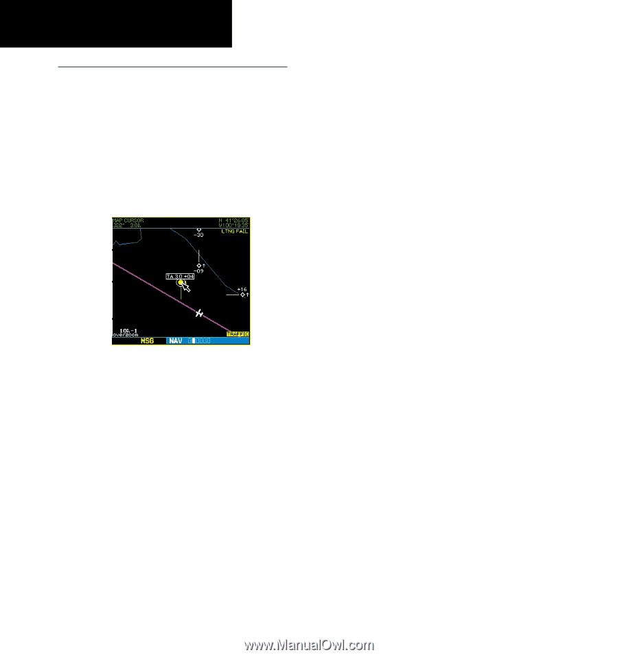
the latitude/longitude position of the pointer, plus
 |
View all Garmin HTAWS manuals
Add to My Manuals
Save this manual to your list of manuals |
Page 14 highlights
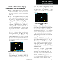
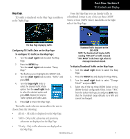
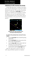
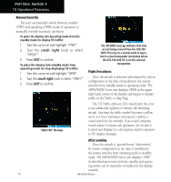
Part One: Section 2 TIS Controls and Display Highlighting TIS Traffic Using Map Page Panning Another Map Page feature is panning, which allows you to move the map beyond its current limits without adjusting the map scale. When you select the panning function - by pressing the small right knob - a target pointer will flash on the map display. A window also appears at the top of the map display showing the latitude/longitude position of the pointer, plus the bearing and distance to the pointer from your present position. Displaying traffic range and altitude separation using the Map Panning feature. To activate the panning feature and pan the map display: 1. Press the small right knob to activate the panning target pointer. 2. Turn the small right knob to move up (turn clock- wise) or down (counterclockwise). 3. Turn the large right knob to move right (turn clockwise) or left (counterclockwise). 4. To cancel the panning function and return to your present position, press the small right knob. When the target pointer is placed on traffic, the traffic range and altitude separation are displayed. 8 190-00356-30 Rev H
-
 1
1 -
2
-
3
-
4
-
5
-
6
-
7
-
8
-
 9
9 -
 10
10 -
 11
11 -
 12
12 -
 13
13 -
 14
14 -
 15
15 -
 16
16 -
 17
17 -
 18
18 -
 19
19 -
20
-
21
-
22
-
23
-
24
-
25
-
26
-
27
-
28
-
29
-
30
-
31
-
32
-
33
-
34
-
35
-
36
-
37
-
38
-
39
-
40
-
41
-
42
-
43
-
44
-
45
-
46
-
47
-
48
-
49
-
50
-
51
-
52
-
53
-
54
-
55
-
56
-
57
-
58
-
59
-
60
-
61
-
62
-
63
-
64
-
65
-
66
-
67
-
68
-
69
-
70
-
71
-
72
-
73
-
74
-
75
-
76
-
77
-
78
 |
 |