Garmin HTAWS User Guide - Page 22
XM Weather METARs Meteorological Aerodrome
 |
View all Garmin HTAWS manuals
Add to My Manuals
Save this manual to your list of manuals |
Page 22 highlights
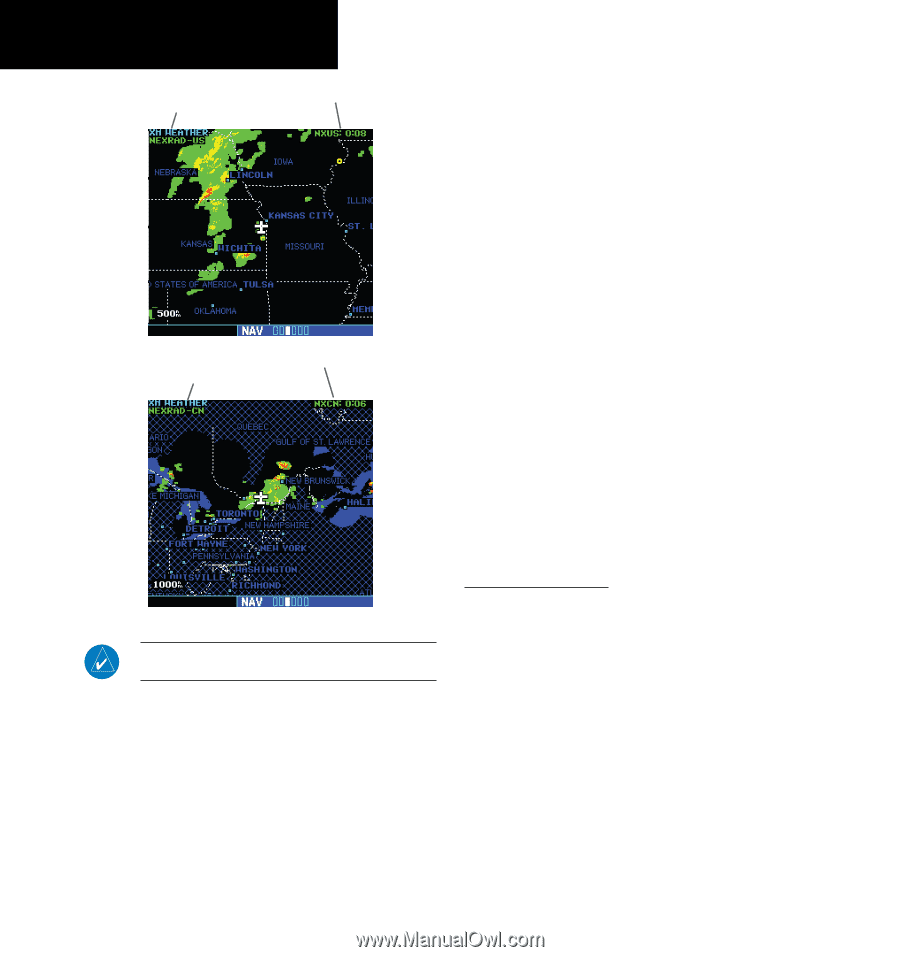
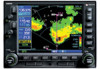
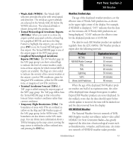
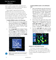
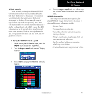
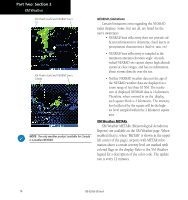
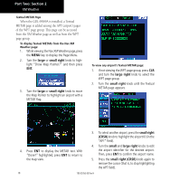
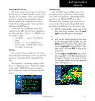
Part Two: Section 2 XM Weather XM Weather Label and NEXRAD Source U.S. XM Weather Label and NEXRAD Source Canada NOTE: The only weather product available for Canada is Canadian NEXRAD. NEXRAD Limitations Certain limitations exist regarding the NEXRAD radar displays. Some, but not all, are listed for the user's awareness: • NEXRAD base reflectivity does not provide sufficient information to determine cloud layers or precipitation characteristics (hail vs. rain, etc). • NEXRAD base reflectivity is sampled at the minimum antenna elevation angle. An individual NEXRAD site cannot depict high altitude storms at close ranges, and has no information about storms directly over the site. • Neither NEXRAD weather data nor the age of the NEXRAD weather data are displayed at a zoom range of less than 10 NM. The resolution of displayed NEXRAD data is 2 kilometers. Therefore, when zoomed in on the display, each square block is 2 kilometers. The intensity level reflected by the square will be the highest level sampled within the 2 kilometer square area. XM Weather METARs XM Weather METARs (Meteorological Aerodrome Reports) are available on the XM Weather page. When enabled (that is, when "METAR" is shown in the upper left corner of the page), airports with METAR information above a certain severity level are marked with colored flags on the display. Refer to the XM Weather legend for a description of the color code. The update rate is every 12 minutes. 16 190-00356-30 Rev H
-
 1
1 -
2
-
3
-
4
-
5
-
6
-
7
-
8
-
9
-
10
-
11
-
12
-
13
-
14
-
15
-
16
-
 17
17 -
 18
18 -
 19
19 -
 20
20 -
 21
21 -
 22
22 -
 23
23 -
 24
24 -
 25
25 -
 26
26 -
 27
27 -
28
-
29
-
30
-
31
-
32
-
33
-
34
-
35
-
36
-
37
-
38
-
39
-
40
-
41
-
42
-
43
-
44
-
45
-
46
-
47
-
48
-
49
-
50
-
51
-
52
-
53
-
54
-
55
-
56
-
57
-
58
-
59
-
60
-
61
-
62
-
63
-
64
-
65
-
66
-
67
-
68
-
69
-
70
-
71
-
72
-
73
-
74
-
75
-
76
-
77
-
78
 |
 |