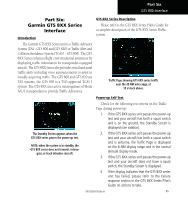
Garmin HTAWS User Guide - Page 70
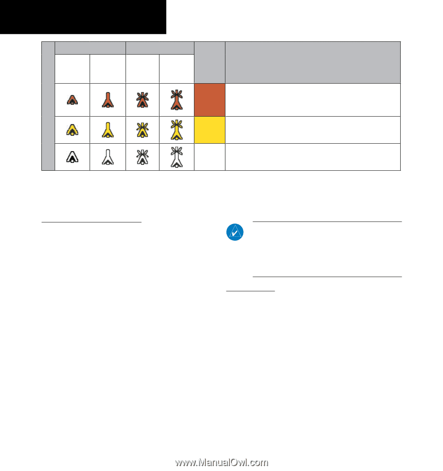
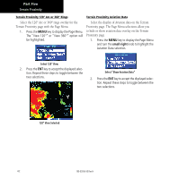
Unlighted Obstacle, Lighted Obstacle, Color, Obstacle Location
 |
View all Garmin HTAWS manuals
Add to My Manuals
Save this manual to your list of manuals |
Page 70 highlights
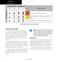
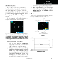
Obstacle Symbol Part Five Terrain Proximity Unlighted Obstacle Lighted Obstacle < 1000 ft > 1000 ft < 1000 ft > 1000 ft AGL AGL AGL AGL Color Obstacle Location Red Obstacle is at or above current aircraft altitude Yellow Obstacle is between 250 ft and 0 ft below current aircraft altitude White Obstacle is 250 ft, or more, below current aircraft altitude Terrain Proximity Obstacle Coloring and Symbology Terrain Proximity Limitations Terrain Proximity displays terrain and obstructions relative to the altitude of the aircraft. Individual obstructions may be shown if available in the database. However, all obstructions may not be available in the database and data may be inaccurate. Never use this information for navigation or to maneuver to avoid obstacles. Terrain Proximity information is based on terrain elevation information in a database that may contain inaccuracies. Terrain Proximity information should be used as an aid to situational awareness. Never use it for navigation or to maneuver to avoid terrain. Terrain Proximity uses terrain and obstacle information supplied by government sources. The displayed information should never be understood as being allinclusive. NOTE: The data contained in the terrain and obstacle databases comes from government agencies. Garmin accurately processes and crossvalidates the data but cannot guarantee the accuracy and completeness of the data. System Status The Terrain Proximity system continually monitors several system-critical items, such as Terrain Proximity database validity, hardware status, and GPS status. The Terrain Proximity page will post the message "NO DATA" when the terrain database is not available. A blue cross-hatching pattern is shown when out of the area of coverage, but no system message is posted. 64 190-00356-30 Rev H
-
 1
1 -
2
-
3
-
4
-
5
-
6
-
7
-
8
-
9
-
10
-
11
-
12
-
13
-
14
-
15
-
16
-
17
-
18
-
19
-
20
-
21
-
22
-
23
-
24
-
25
-
26
-
27
-
28
-
29
-
30
-
31
-
32
-
33
-
34
-
35
-
36
-
37
-
38
-
39
-
40
-
41
-
42
-
43
-
44
-
45
-
46
-
47
-
48
-
49
-
50
-
51
-
52
-
53
-
54
-
55
-
56
-
57
-
58
-
59
-
60
-
61
-
62
-
63
-
64
-
 65
65 -
 66
66 -
 67
67 -
 68
68 -
 69
69 -
 70
70 -
 71
71 -
 72
72 -
 73
73 -
 74
74 -
 75
75 -
76
-
77
-
78
 |
 |