Garmin HTAWS User Guide - Page 59
Part Four,
 |
View all Garmin HTAWS manuals
Add to My Manuals
Save this manual to your list of manuals |
Page 59 highlights
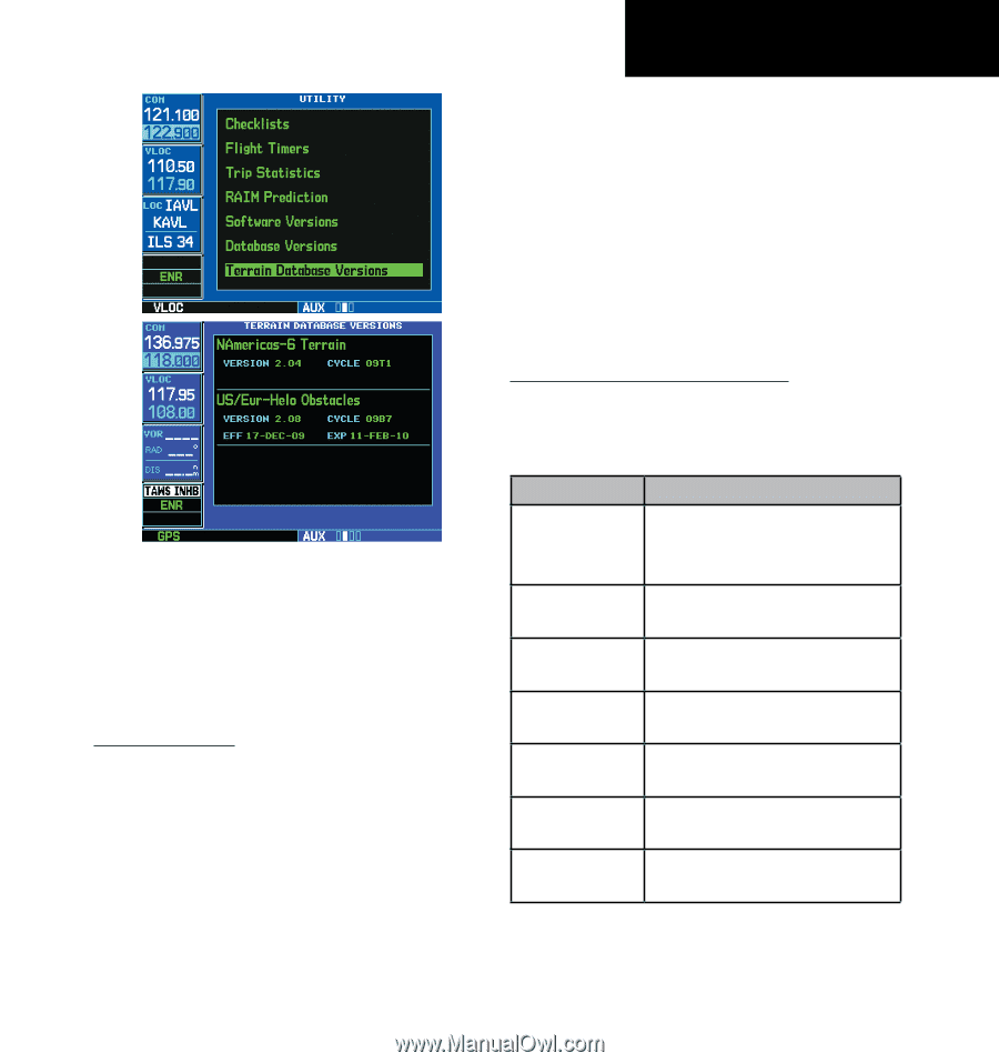
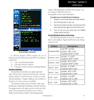
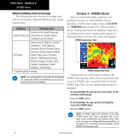
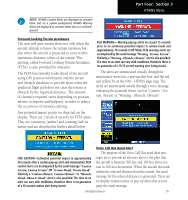
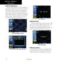
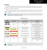
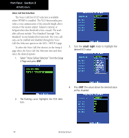
Part Four: Section 3 HTAWS Alerts using a USB programmer available from Garmin. Contact Garmin at 800-800-1020 or at www.garmin.com for more information. To update your terrain/obstacle databases: 1. Acquire a new terrain data card from Garmin. 2. Turn off the power to the unit. 3. Remove the old terrain data card and insert the new card into the right-most slot of the unit. 4. Turn on the unit and verify that the HTAWS system passes self-test. Terrain Database Areas of Coverage The following describes the area of coverage available in each database. Regional definitions may change without notice. Database Coverage Area Cycle 09T1, and later: Terrain Database Information To function properly HTAWS requires the use of databases specific to helicopters and HTAWS. The databases required are: 1) 6 arc-second Terrain Database 2) Helicopter Obstacle Database 3) Helicopter Aviation Database including Heliports Database Updates Terrain/obstacle databases are updated periodically with the latest terrain and obstacle data. Visit the Garmin website to check for newer versions of terrain/ obstacle databases. Compare database cycle numbers to Worldwide (WW) Americas - North Americas - South Atlantic - North Atlantic - South Pacific - North Latitudes: N90° to S90° Longitudes: W180° to E180° Latitudes: 0° to N90° Longitudes: W180° to W30° Latitudes: N30° to S90° Longitudes: W180° to W30° Latitudes: 0° to N90° Longitudes: W30° to E90° Latitudes: N30° to S90° Longitudes: W30° to E90° Latitudes: 0° to N90° Longitudes: E60° to E180° determine if a newer version is available. The database update process includes either repro- gramming or replacing the database card and inserting Pacific - South Latitudes: N30° to S90° Longitudes: E60° to E180° the updated card in the right card slot on the unit front panel. The terrain/obstacle database may be down- loaded via the internet and the card reprogrammed 190-00356-30 Rev H 53
-
 1
1 -
2
-
3
-
4
-
5
-
6
-
7
-
8
-
9
-
10
-
11
-
12
-
13
-
14
-
15
-
16
-
17
-
18
-
19
-
20
-
21
-
22
-
23
-
24
-
25
-
26
-
27
-
28
-
29
-
30
-
31
-
32
-
33
-
34
-
35
-
36
-
37
-
38
-
39
-
40
-
41
-
42
-
43
-
44
-
45
-
46
-
47
-
48
-
49
-
50
-
51
-
52
-
53
-
 54
54 -
 55
55 -
 56
56 -
 57
57 -
 58
58 -
 59
59 -
 60
60 -
 61
61 -
 62
62 -
 63
63 -
 64
64 -
65
-
66
-
67
-
68
-
69
-
70
-
71
-
72
-
73
-
74
-
75
-
76
-
77
-
78
 |
 |