Garmin HTAWS User Guide - Page 53
Part Four,
 |
View all Garmin HTAWS manuals
Add to My Manuals
Save this manual to your list of manuals |
Page 53 highlights
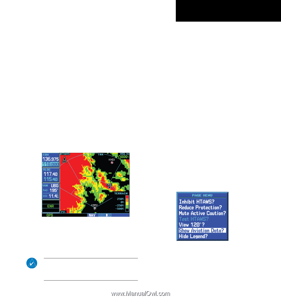
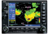
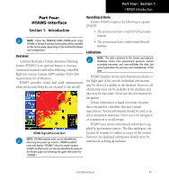
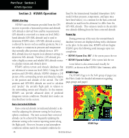
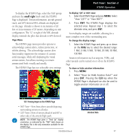
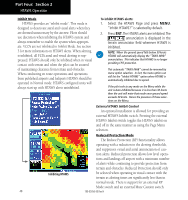
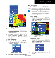
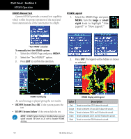
Part Four: Section 2 HTAWS Operation To display the HTAWS Page, select the NAV group and turn the small right knob until the HTAWS Page is displayed. Terrain information, aircraft ground track, and GPS-derived MSL altitude are displayed on the page. Altitude is shown in increments of 20 feet or in increments of 10 meters, depending on unit configuration. The "G" to right of the MSL altitude display reminds the pilot that altitude is GPS-derived. Page Menu The HTAWS page menu provides options to acknowledge caution alerts, reduce protection, or inhibit alerting. The acknowledge caution alert functionality suppresses the issuance of caution aural messages, while still displaying the visual annunciations, but allows warnings to remain annunciated both visually and aurally. The HTAWS Page has two selectable view settings: To display 120˚ or 360˚ view: 1. Select the HTAWS Page and press MENU. Select "View 120˚?" or "View 360˚?". 2. Press ENT. The HTAWS Page displays the selected view. Repeat step 1 to select the alternate view, and press ENT. Seven display ranges are available, allowing for a more complete view of the surrounding area. To change the display range: 1. Select the HTAWS Page and press up or down on the RNG key to select the desired range: 1 NM, 2 NM, 5 NM, 10 NM, 25 NM, 50 NM, 100 NM. Aviation information such as airports, VORs, and other navaids can be turned on or off on the HTAWS Page. To show or hide aviation information: 1. Press MENU. 2. Select "Show (or Hide) Aviation Data?" and press ENT. Pressing the CLR key when the HTAWS Page is displayed can also be used to toggle aviation information on or off. 120˚ Viewing Angle on the HTAWS Page • 360˚ View-View from above aircraft depicting surrounding terrain on all sides. • 120˚ View-View of terrain ahead of and 60˚ to either side of the aircraft flight path. Aviation Data NOTE: The HTAWS Page gives a "Track Up" display orientation, as indicated by the "TRK" label shown on the display. This is the only orientation available for the HTAWS Page. 190-00356-30 Rev H 47
-
 1
1 -
2
-
3
-
4
-
5
-
6
-
7
-
8
-
9
-
10
-
11
-
12
-
13
-
14
-
15
-
16
-
17
-
18
-
19
-
20
-
21
-
22
-
23
-
24
-
25
-
26
-
27
-
28
-
29
-
30
-
31
-
32
-
33
-
34
-
35
-
36
-
37
-
38
-
39
-
40
-
41
-
42
-
43
-
44
-
45
-
46
-
47
-
 48
48 -
 49
49 -
 50
50 -
 51
51 -
 52
52 -
 53
53 -
 54
54 -
 55
55 -
 56
56 -
 57
57 -
 58
58 -
59
-
60
-
61
-
62
-
63
-
64
-
65
-
66
-
67
-
68
-
69
-
70
-
71
-
72
-
73
-
74
-
75
-
76
-
77
-
78
 |
 |