Garmin HTAWS User Guide - Page 58
sions located in the AUX Group. Databases
 |
View all Garmin HTAWS manuals
Add to My Manuals
Save this manual to your list of manuals |
Page 58 highlights
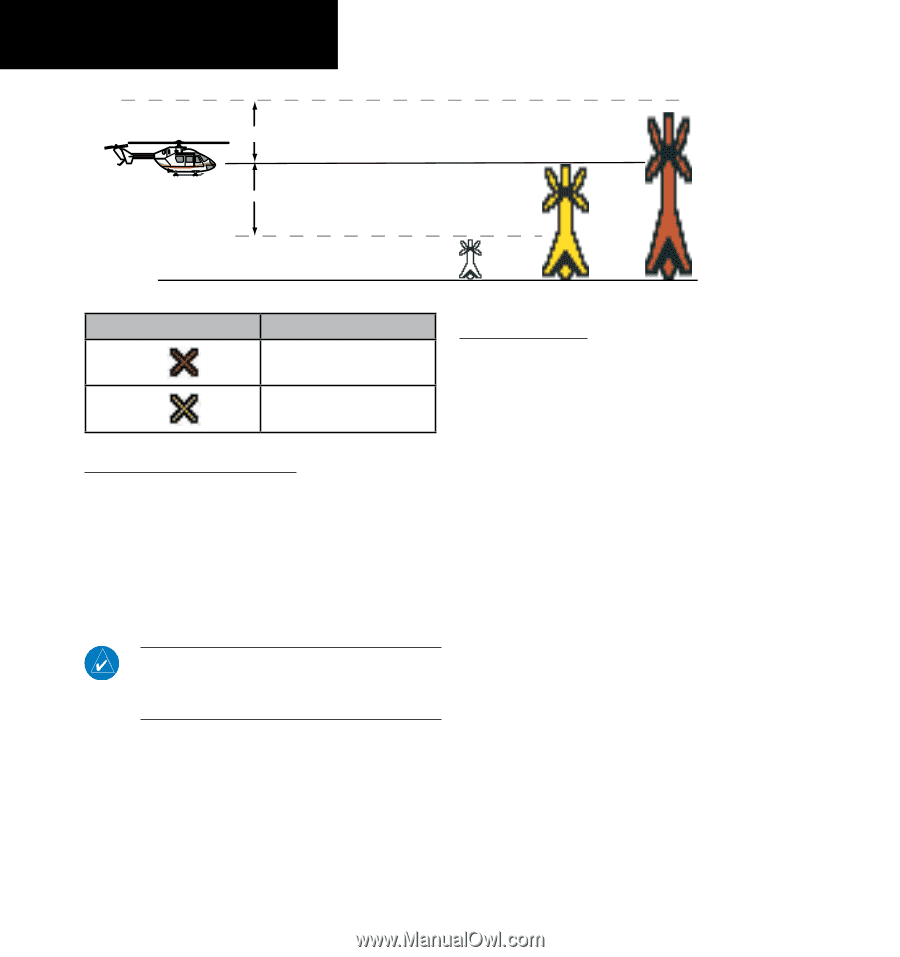
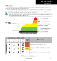
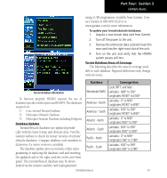
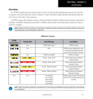
Part Four: Section 2 HTAWS Operation 250 ft Obstacle is at or above the aircraft altitude (Red) 250 ft Obstacle is between 250 ft and 0 ft below the aircraft altitude (Yellow) Obstacle is 250 ft, or more, below the aircraft altitude (Gray) HTAWS Obstacle Altitude Colors and Symbology Potential Impact Point Alert Level WARNING (Red) CAUTION (Yellow) HTAWS Alert Coloring and Symbology General Database Information Garmin HTAWS uses terrain and obstacle information supplied by government sources. The data undergoes verification by Garmin to confirm accuracy of the content. However, the displayed information should never be understood as being all-inclusive. Pilots must familiarize themselves with the appropriate charts for safe flight. Database Versions The version and area of coverage of each terrain/ obstacle database is shown on the Terrain Database Versions Page, located in the AUX Page Group. Databases are checked for integrity at power-up. If a database is found to be missing and/or deficient, the HTAWS system fails the self-test and displays the HTAWS system failure message. NOTE: The data contained in the terrain and obstacle databases comes from government agencies. Garmin accurately processes and cross-validates the data, but cannot guarantee the accuracy and completeness of the data. The terrain/obstacle databases are contained on a datacard which is inserted in the right-most slot of the 400W/500W Series units. 52 190-00356-30 Rev H
-
 1
1 -
2
-
3
-
4
-
5
-
6
-
7
-
8
-
9
-
10
-
11
-
12
-
13
-
14
-
15
-
16
-
17
-
18
-
19
-
20
-
21
-
22
-
23
-
24
-
25
-
26
-
27
-
28
-
29
-
30
-
31
-
32
-
33
-
34
-
35
-
36
-
37
-
38
-
39
-
40
-
41
-
42
-
43
-
44
-
45
-
46
-
47
-
48
-
49
-
50
-
51
-
52
-
 53
53 -
 54
54 -
 55
55 -
 56
56 -
 57
57 -
 58
58 -
 59
59 -
 60
60 -
 61
61 -
 62
62 -
 63
63 -
64
-
65
-
66
-
67
-
68
-
69
-
70
-
71
-
72
-
73
-
74
-
75
-
76
-
77
-
78
 |
 |