Garmin HTAWS User Guide - Page 38
TAWS Operation - taws update
 |
View all Garmin HTAWS manuals
Add to My Manuals
Save this manual to your list of manuals |
Page 38 highlights
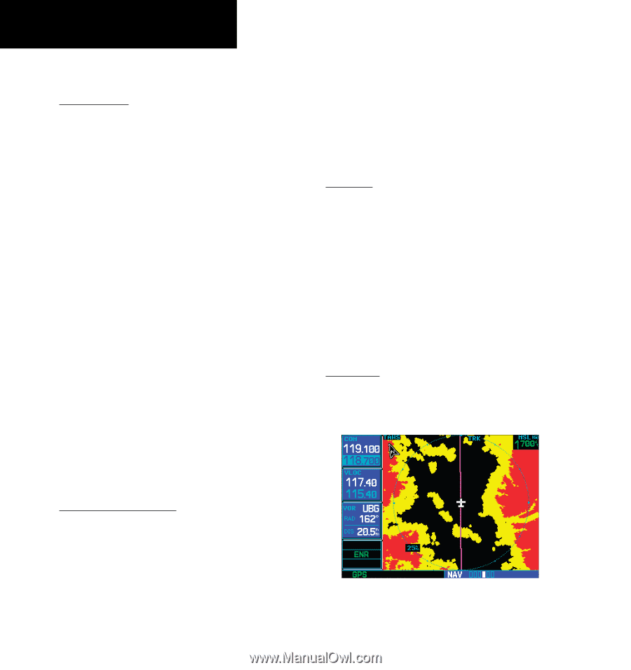
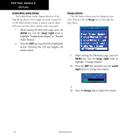
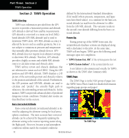
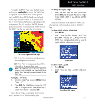
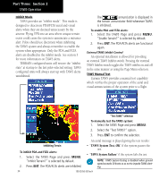
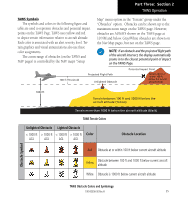
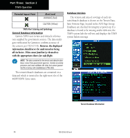
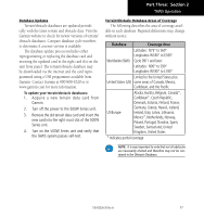
Part Three: Section 2 TAWS Operation Section 2: TAWS Operation TAWS Alerting TAWS uses information provided from the GPS receiver to provide a horizontal position and altitude. GPS altitude is derived from satellite measurements. GPS altitude is converted to a mean sea level (MSL)based altitude (GPS-MSL altitude) and is used to determine TAWS alerts. GPS-MSL altitude accuracy is affected by factors such as satellite geometry, but it is not subject to variations in pressure and temperature that normally affect pressure altitude devices. GPSMSL altitude does not require local altimeter settings to determine MSL altitude. Therefore, GPS altitude provides a highly accurate and reliable MSL altitude source to calculate terrain and obstacle alerts. TAWS utilizes terrain and obstacle databases that are referenced to mean sea level (MSL). Using the GPS position and GPS-MSL altitude, TAWS displays a 2-D picture of the surrounding terrain and obstacles relative to the position and altitude of the aircraft. Furthermore, the GPS position and GPS-MSL altitude are used to calculate and "predict" the aircraft's flight path in relation to the surrounding terrain and obstacles. In this manner, TAWS can provide advanced alerts of predicted dangerous terrain conditions. Detailed alert modes are described later in this section. defined by the International Standard Atmosphere (ISA) model (where pressure, temperature, and lapse rates have fixed values), it is common for the baro-corrected altitude (as read from the altimeter) to differ from the GPS-MSL altitude. This variation results in the aircraft's true altitude differing from the baro-corrected altitude. Power Up During power-up of the 500W Series unit, the terrain/obstacle database versions are displayed along with a disclaimer to the pilot. At the same time, TAWS self-test begins. TAWS gives the following aural messages upon test completion: • "TAWS System Test, OK", if the system passes the test • "TAWS System Failure", if the system fails the test A test failure is also annunciated visually for TAWS, as shown in the TAWS Alert Summary table. TAWS Page The TAWS Page is in the NAV group of pages (see the 500W Series Pilot's Guide for detailed information regarding page groups and pages). Baro-Corrected Altitude Baro-corrected altitude (or indicated altitude) is derived by adjusting the altimeter setting for local atmospheric conditions. The most accurate baro-corrected altitude can be achieved by frequently updating the altimeter setting to the nearest reporting station along the flight path. However, because actual atmosphere conditions seldom match the standard conditions 32 190-00356-30 Rev H The TAWS Page
-
 1
1 -
2
-
3
-
4
-
5
-
6
-
7
-
8
-
9
-
10
-
11
-
12
-
13
-
14
-
15
-
16
-
17
-
18
-
19
-
20
-
21
-
22
-
23
-
24
-
25
-
26
-
27
-
28
-
29
-
30
-
31
-
32
-
 33
33 -
 34
34 -
 35
35 -
 36
36 -
 37
37 -
 38
38 -
 39
39 -
 40
40 -
 41
41 -
 42
42 -
 43
43 -
44
-
45
-
46
-
47
-
48
-
49
-
50
-
51
-
52
-
53
-
54
-
55
-
56
-
57
-
58
-
59
-
60
-
61
-
62
-
63
-
64
-
65
-
66
-
67
-
68
-
69
-
70
-
71
-
72
-
73
-
74
-
75
-
76
-
77
-
78
 |
 |