Garmin HTAWS User Guide - Page 67
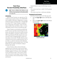
Part Five, Terrain Proximity Interface
 |
View all Garmin HTAWS manuals
Add to My Manuals
Save this manual to your list of manuals |
Page 67 highlights
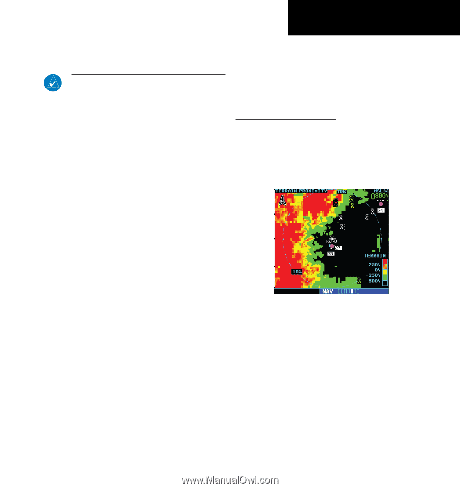
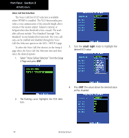
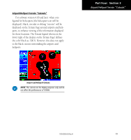
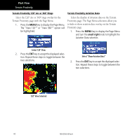
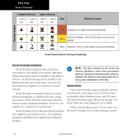
Part Five Terrain Proximity Part Five: Terrain Proximity Interface NOTE: Either the TERRAIN, TAWS (500W-series only), HTAWS, or Terrain Proximity functionality will be available via the Terrain page, depending on the installed hardware and configuration. . Introduction Garmin Terrain Proximity is an optional non-TSOcertified terrain awareness feature of the 400W/500W series available in helicopter configurations to increase situational awareness and help reduce controlled flight into terrain (CFIT). Terrain Proximity is available in the Nav page group Terrain pages. Terrain Proximity depicts nearby terrain and obstacles relative to the aircraft altitude, however it does not provide any alerts. Terrain Proximity requires the following to operate properly: • The system must have a valid 3-D GPS position solution. • The system must have a valid terrain database. Displaying Terrain Proximity The Terrain Proximity page is in the Map page group. 1. Turn the large right knob to the Map func- tion. 2. Then, the small right knob to the Terrain Proximity page. Terrain Proximity uses information provided from the GPS receiver to provide a horizontal position and altitude. GPS altitude is derived from satellite measurements. GPS altitude is converted to a Mean Sea Level (MSL)-based altitude (GPS-MSL altitude) and is used to provide terrain coloring that depicts terrain elevation relative to the aircraft. GPS-MSL altitude accuracy is affected by factors such as satellite geometry, but it is not subject to variations in pressure and temperature that normally affect pressure altitude devices. GPS-MSL altitude does not require local altimeter settings to determine MSL altitude. Terrain Proximity Page Terrain Proximity utilizes terrain and obstacle databases that are referenced to mean sea level (MSL). Using the GPS position and GPS-MSL altitude, Terrain Proximity displays a 2-D picture of the surrounding terrain and obstacles relative to the position and alti- tude of the aircraft. In this manner, Terrain Proximity increases awareness of the aircraft proximity to terrain and obstacles. 190-00356-30 Rev H 61
-
 1
1 -
2
-
3
-
4
-
5
-
6
-
7
-
8
-
9
-
10
-
11
-
12
-
13
-
14
-
15
-
16
-
17
-
18
-
19
-
20
-
21
-
22
-
23
-
24
-
25
-
26
-
27
-
28
-
29
-
30
-
31
-
32
-
33
-
34
-
35
-
36
-
37
-
38
-
39
-
40
-
41
-
42
-
43
-
44
-
45
-
46
-
47
-
48
-
49
-
50
-
51
-
52
-
53
-
54
-
55
-
56
-
57
-
58
-
59
-
60
-
61
-
 62
62 -
 63
63 -
 64
64 -
 65
65 -
 66
66 -
 67
67 -
 68
68 -
 69
69 -
 70
70 -
 71
71 -
 72
72 -
73
-
74
-
75
-
76
-
77
-
78
 |
 |