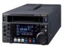
Sony HDWS280 Product Manual (Operation Manual 1st Edition (Revised 5)) - Page 59
S+Xm Y+D, S 1st character, 2nd character, between Y and D, LONGITUDE, Example, LATITUDE,
 |
View all Sony HDWS280 manuals
Add to My Manuals
Save this manual to your list of manuals |
Page 59 highlights
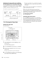
S+XXXXXXXm Y+D: Altitude data indicating the distance from sea level is displayed in this format. The meaning of the characters and strings shown is as follows. S (1st character): Indicates data from a Sensor. R is shown for position data from the recording device (Recorder), and T is shown for Target position data. + (2nd character): Indicates higher than sea level. − indicates lower than sea level. XXXXXXXm: Altitude data (in unit of meters). Y: The number of satellites used to calculate position data (hexadecimal) D: DOP (Dilution of Precision) value + (between Y and D): Displayed when a support apparatus was used. A space (blank) is displayed when no support apparatus was used. f LONGITUDE Following W to indicate west longitude or E to indicate east longitude, the longitude is displayed in degrees, minutes, and seconds (seconds are shown in up to 2 decimal places). Example: E134 59'23"00 for East longitude 134 degrees 59 minutes 23 seconds 00 g LATITUDE Following N to indicate north latitude or S to indicate south latitude, the latitude is displayed in degrees, minutes, and seconds (seconds are shown in up to 2 decimal places). Example: N34 59'23"32 for North latitude of 34 degrees 59 minutes 23 seconds 32 h ORGANIZATION Organization code i USER/COUNTRY User code and country code 59 UMID Output and Display Chapter 8 UMID Functions
-
 1
1 -
2
-
3
-
4
-
5
-
6
-
7
-
8
-
9
-
10
-
11
-
12
-
13
-
14
-
15
-
16
-
17
-
18
-
19
-
20
-
21
-
22
-
23
-
24
-
25
-
26
-
27
-
28
-
29
-
30
-
31
-
32
-
33
-
34
-
35
-
36
-
37
-
38
-
39
-
40
-
41
-
42
-
43
-
44
-
45
-
46
-
47
-
48
-
49
-
50
-
51
-
52
-
53
-
 54
54 -
 55
55 -
 56
56 -
 57
57 -
 58
58 -
 59
59 -
 60
60 -
 61
61 -
 62
62 -
 63
63 -
 64
64 -
65
-
66
-
67
-
68
-
69
-
70
-
71
-
72
-
73
-
74
-
75
-
76
-
77
-
78
-
79
-
80
-
81
-
82
-
83
-
84
-
85
-
86
-
87
-
88
-
89
-
90
-
91
-
92
-
93
-
94
 |
 |
