Garmin GPS III Plus Owner's Manual - Page 45
Common Exits, Special Exits
 |
UPC - 753759015817
View all Garmin GPS III Plus manuals
Add to My Manuals
Save this manual to your list of manuals |
Page 45 highlights
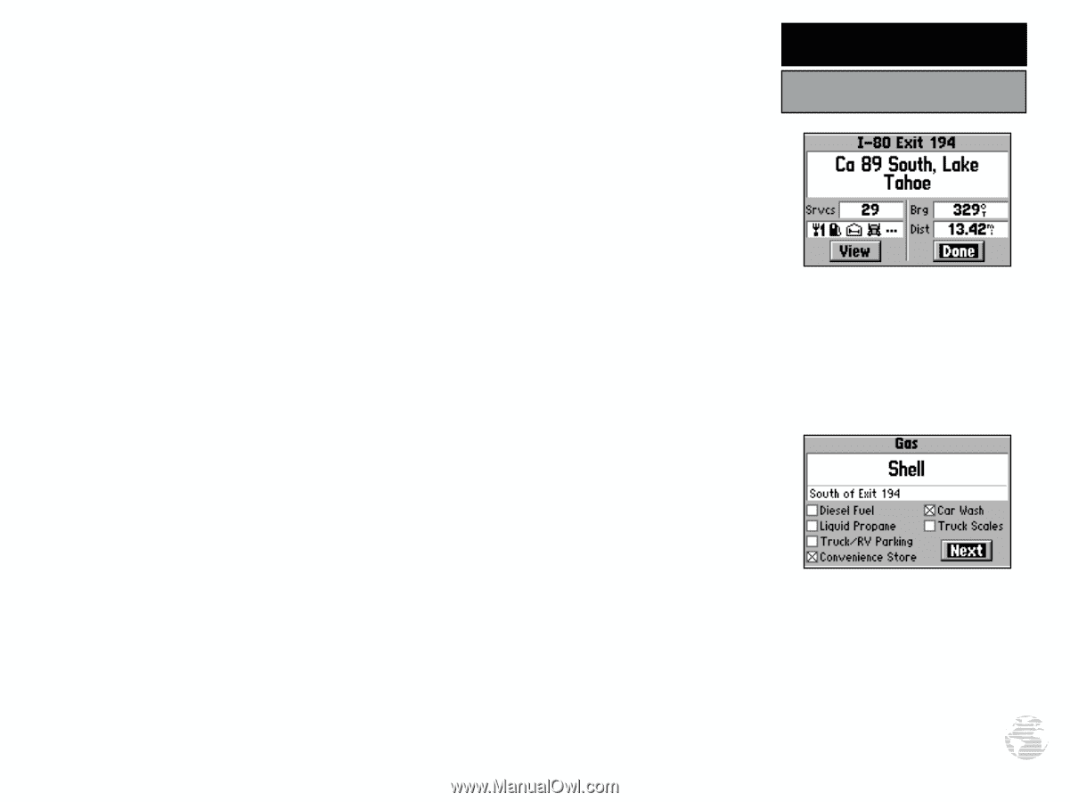
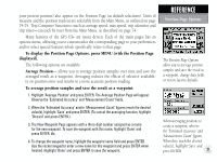
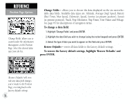
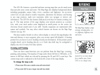
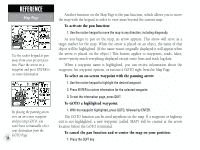
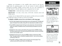
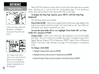
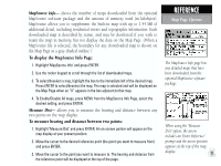
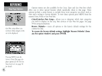
Highway exit information is also available when using the pan function. Simply place the panning pointer over the exit location to retrieve additional information-including available services-about the exit. Exit information is generally limited to interstate highways and is categorized into two types: Common Exits- traditional ramp, cloverleaf or intersection exits. Special Exits- rest areas, service areas, toll booths, welcome centers and weigh stations. Common exits are depicted with an open square icon when services are available and a filled-gray square icon when no services are available. To display available services for an exit shown on the map page: 1. Use the rocker keypad to place the panning arrow on the desired exit. A window will appear showing the exit number, along with icons depicting the available services. 2. Press ENTER to display the Exit Info Page for the selected exit. The Exit Info Page shows the number of available services, and the bearing and distance to the exit location. 3. Highlight the "View" button at the bottom of the page and press ENTER to display the Services Near Exit List. The Services Near Exit List shows a service icon and the name for each available service. 4. Highlight the desired service and press ENTER to display an Exit Service Detail Page. This page provides a checklist of available services-such as fuels, parking, convenience stores, etc. 5. Press QUIT, as often as needed, to back out of each exit services page. If you continue to press QUIT, you will return to the Map Page. REFERENCE Map Page: Exits For a selected highway exit, the Exit Info Page displays the number of available services and icons depicting the type of available services. The Exit Services Detail Page provides a checklist of available services. Start from the Services Near Exit List and select the desired service to display this page. 35
-
 1
1 -
2
-
3
-
4
-
5
-
6
-
7
-
8
-
9
-
10
-
11
-
12
-
13
-
14
-
15
-
16
-
17
-
18
-
19
-
20
-
21
-
22
-
23
-
24
-
25
-
26
-
27
-
28
-
29
-
30
-
31
-
32
-
33
-
34
-
35
-
36
-
37
-
38
-
39
-
 40
40 -
 41
41 -
 42
42 -
 43
43 -
 44
44 -
 45
45 -
 46
46 -
 47
47 -
 48
48 -
 49
49 -
 50
50 -
51
-
52
-
53
-
54
-
55
-
56
-
57
-
58
-
59
-
60
-
61
-
62
-
63
-
64
-
65
-
66
-
67
-
68
-
69
-
70
-
71
-
72
-
73
-
74
-
75
-
76
-
77
-
78
-
79
-
80
-
81
-
82
-
83
-
84
-
85
-
86
-
87
-
88
-
89
-
90
-
91
-
92
-
93
-
94
-
95
-
96
-
97
-
98
-
99
-
100
-
101
-
102
-
103
-
104
-
105
-
106
-
107
-
108
-
109
-
110
-
111
-
112
-
113
-
114
 |
 |