Garmin GPS III Plus Owner's Manual - Page 48
Nearest to Pntr Pointer - updates for
 |
UPC - 753759015817
View all Garmin GPS III Plus manuals
Add to My Manuals
Save this manual to your list of manuals |
Page 48 highlights
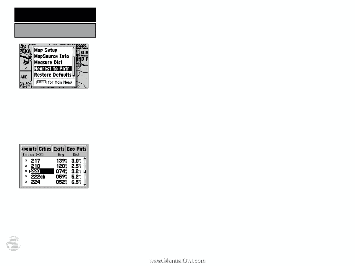
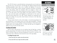
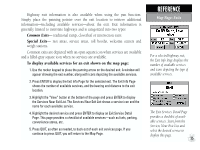
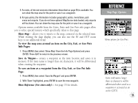
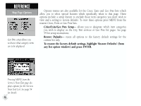
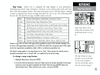
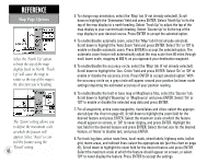
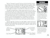
REFERENCE Map Page Options The 'Nearest to Pntr' option will only be available when the pointer is moved on the screen. The exit with the arrow to the left of the number is the next exit ahead, given your direction of travel. Exits which appear above in the list are the closest the opposite direction. 38 Nearest to Pntr (Pointer)- allows you to view the bearing and distance of the nine nearest waypoints, 50 nearest cities, 50 exits on the nearest (interstate) highway and 50 geo (geographical) points nearest to the map pointer. The nearest locations pages are organized by a series of 'file tabs' (denoting categories for Waypoints, Cities, Exits and Geo Points) and display the bearing (BRG) and distance (DST) to each nearby location for the selected tab (category). The lists are continuously updated as you're moving and provide quick access to the closest points of safety in an emergency. To view points nearest the map pointer: 1. Use the rocker keypad to move the cursor to the desired position on the Map Page. 2. Press the MENU key, then highlight 'Nearest to Pntr' and press ENTER. 3. Highlight the appropriate tab (Waypoints, Cities, Exits or Geo Pnts) for the desired nearest list. 4. Scroll through the list using the UP/DOWN portion of the rocker keypad. To view additional information for a nearby item: 1. Scroll through the selected nearest list (as described above) and highlight the desired item (Waypoint, City, Exit or Geo Pnts). 2. Press ENTER to display the info page for the selected item. 3. For waypoints, the information is displayed on the Waypoint Edit Page. You can edit the waypoint's location, name, symbol, etc. from this page, as outlined on pages 50-51. 4. For cities, the information includes state, country, size or reference, and position. You can show the map area for the city, save it as a waypoint or switch between city size and reference information as described on pages 69-70.
-
 1
1 -
2
-
3
-
4
-
5
-
6
-
7
-
8
-
9
-
10
-
11
-
12
-
13
-
14
-
15
-
16
-
17
-
18
-
19
-
20
-
21
-
22
-
23
-
24
-
25
-
26
-
27
-
28
-
29
-
30
-
31
-
32
-
33
-
34
-
35
-
36
-
37
-
38
-
39
-
40
-
41
-
42
-
 43
43 -
 44
44 -
 45
45 -
 46
46 -
 47
47 -
 48
48 -
 49
49 -
 50
50 -
 51
51 -
 52
52 -
 53
53 -
54
-
55
-
56
-
57
-
58
-
59
-
60
-
61
-
62
-
63
-
64
-
65
-
66
-
67
-
68
-
69
-
70
-
71
-
72
-
73
-
74
-
75
-
76
-
77
-
78
-
79
-
80
-
81
-
82
-
83
-
84
-
85
-
86
-
87
-
88
-
89
-
90
-
91
-
92
-
93
-
94
-
95
-
96
-
97
-
98
-
99
-
100
-
101
-
102
-
103
-
104
-
105
-
106
-
107
-
108
-
109
-
110
-
111
-
112
-
113
-
114
 |
 |