Magellan Meridian Platinum User Manual - Page 40
Changing the Data Fields, Street Information Description, Horizontal Profile Description
 |
UPC - 763357103267
View all Magellan Meridian Platinum manuals
Add to My Manuals
Save this manual to your list of manuals |
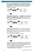
Page 40 highlights
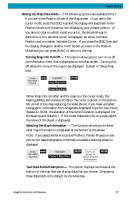
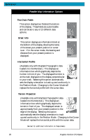
Reference Changing the Data Fields - Allows you to change the data that is being displayed to 1 of 13 different data options (bearing, distance, speed, heading, VMG, CTS, ETA, ETE, XTE, turn, elevation, time, or date). Note: If you have selected Hide Map Info, this option will not be available in the menu. Also, you must have the Two Data Fields displayed on the Map screen to be able to customize them. Press [ESC] when you are done to leave the customize mode. From MENU Highlight ENTER the MAP Screen Select Map Info Highlight Customize Fields See note A ENTER Use L/R arrows to ENTER Use arrows to ENTER ESC highlight the title select new for the data field to data type be changed Note A: If there is not a menu option for "Customize Fields", highlight "Two Data Fields" and press ENTER. Then repeat this operation. Street Information Description - This mode just displays the name of the street close to your present position. Horizontal Profile Description - (This function requires that map data has been uploaded from Magellan MapSend Topo for the United States and that your present position as well as the projected horizon falls within the area uploaded.) This mode displays at the bottom of the Map screen a graphical representation of the horizon at a fixed distance from your present position. This fixed distance is equal to the map scale you have selected for the Map screen, so as you zoom in or out, the horizon displayed will change. In the Horizon Profile mode, you will also notice a line projected out from your present position icon to a shorter perpendicular line. The intersection of the two lines indicates the location on the map where the horizon is being computed. You should note that when you select Horizontal Profile, your Map Orientation will change to "Track Up" so you may need to change that when you are done viewing the horizontal profile. If you change Orientation to something other then Track Up while viewing the Horizontal Profile, the default Two Data Fields is displayed. Changing the Orientation back to "Track Up" will revert back to the Horizontal Profile. Magellan Meridian GPS Receiver 29
-
 1
1 -
2
-
3
-
4
-
5
-
6
-
7
-
8
-
9
-
10
-
11
-
12
-
13
-
14
-
15
-
16
-
17
-
18
-
19
-
20
-
21
-
22
-
23
-
24
-
25
-
26
-
27
-
28
-
29
-
30
-
31
-
32
-
33
-
34
-
 35
35 -
 36
36 -
 37
37 -
 38
38 -
 39
39 -
 40
40 -
 41
41 -
 42
42 -
 43
43 -
 44
44 -
 45
45 -
46
-
47
-
48
-
49
-
50
-
51
-
52
-
53
-
54
-
55
-
56
-
57
-
58
-
59
-
60
-
61
-
62
-
63
-
64
-
65
-
66
-
67
-
68
-
69
-
70
-
71
-
72
-
73
-
74
-
75
-
76
-
77
-
78
-
79
-
80
-
81
-
82
-
83
-
84
-
85
-
86
-
87
-
88
-
89
-
90
-
91
-
92
-
93
-
94
-
95
-
96
-
97
-
98
-
99
-
100
-
101
-
102
-
103
-
104
-
105
 |
 |
