Garmin Forerunner 945 LTE Owners Manual - Page 84
Compass, Navigation Settings, Customizing Map Features, Setting Up a Heading Bug
 |
View all Garmin Forerunner 945 LTE manuals
Add to My Manuals
Save this manual to your list of manuals |
Page 84 highlights
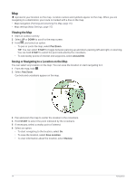
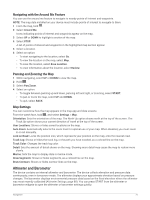
Compass The device has a 3-axis compass with automatic calibration. The compass features and appearance change depending on your activity, whether GPS is enabled, and whether you are navigating to a destination. You can change the compass settings manually (Compass Settings, page 87). To open the compass settings quickly, you can select START from the compass widget. Navigation Settings You can customize the map features and appearance when navigating to a destination. Customizing Map Features 1 Hold . 2 Select Settings > Navigation > Data Screens. 3 Select an option: • Select Map to turn on or off the map. • Select Elevation Plot to turn on or off the elevation plot. • Select a screen to add, remove, or customize. Setting Up a Heading Bug You can set up a heading indicator to display on your data pages while navigating. The indicator points to your target heading. 1 Hold . 2 Select Settings > Navigation > Heading Bug. Setting Navigation Alerts You can set alerts to help you navigate to your destination. 1 Hold . 2 Select Settings > Navigation > Alerts. 3 Select an option: • To set an alert for a specified distance from your final destination, select Final Distance. • To set an alert for the estimated time remaining until you reach your final destination, select Final ETE. • To set an alert when you stray from the course, select Off Course. • To enable turn-by-turn navigation prompts, select Turn Prompts. 4 If necessary, select Status to turn on the alert. 5 If necessary, enter a distance or time value, and select . Wireless Sensors Your device can be used with wireless ANT+ or Bluetooth sensors. For more information about compatibility and purchasing optional sensors, go to buy.garmin.com. 76 Wireless Sensors
-
 1
1 -
2
-
3
-
4
-
5
-
6
-
7
-
8
-
9
-
10
-
11
-
12
-
13
-
14
-
15
-
16
-
17
-
18
-
19
-
20
-
21
-
22
-
23
-
24
-
25
-
26
-
27
-
28
-
29
-
30
-
31
-
32
-
33
-
34
-
35
-
36
-
37
-
38
-
39
-
40
-
41
-
42
-
43
-
44
-
45
-
46
-
47
-
48
-
49
-
50
-
51
-
52
-
53
-
54
-
55
-
56
-
57
-
58
-
59
-
60
-
61
-
62
-
63
-
64
-
65
-
66
-
67
-
68
-
69
-
70
-
71
-
72
-
73
-
74
-
75
-
76
-
77
-
78
-
 79
79 -
 80
80 -
 81
81 -
 82
82 -
 83
83 -
 84
84 -
 85
85 -
 86
86 -
 87
87 -
 88
88 -
 89
89 -
90
-
91
-
92
-
93
-
94
-
95
-
96
-
97
-
98
-
99
-
100
-
101
-
102
-
103
-
104
-
105
-
106
-
107
-
108
-
109
-
110
-
111
-
112
-
113
-
114
-
115
-
116
-
117
-
118
-
119
-
120
-
121
-
122
-
123
-
124
-
125
-
126
 |
 |