Garmin GPSMAP 298C Owner's Manual - Page 39
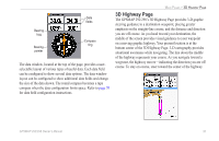
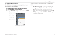
D Highway The GPSMAP 292/298's 3D Highway provides 3-D graphic
 |
UPC - 753759052072
View all Garmin GPSMAP 298C manuals
Add to My Manuals
Save this manual to your list of manuals |
Page 39 highlights
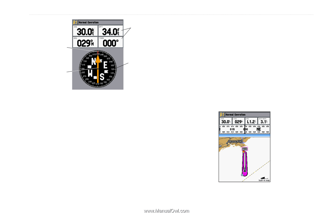
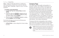
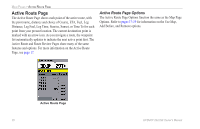
Bearing bug Bearing pointer Data fields Compass ring The data window, located at the top of the page, provides a userselectable layout of various types of useful data. Each data field can be configured to show several data options. The data window layout can be configured to show additional data fields and change the size of the data shown. The round compass becomes a tape compass when the data configuration limits space. Refer to page 30 for data field configuration instructions. MAIN PAGES > 3D HIGHWAY PAGE 3D Highway Page The GPSMAP 292/298's 3D Highway Page provides 3-D graphic steering guidance to a destination waypoint, placing greater emphasis on the straight-line course, and the distance and direction you are off course. As you head toward your destination, the middle of the screen provides visual guidance to your waypoint on a moving graphic highway. Your present location is at the bottom center of the 3D Highway Page. 3-D cartography provides situational awareness while navigating. The line down the middle of the highway represents your course. As you navigate toward a waypoint, the highway moves-indicating the direction you are off course. To stay on course, steer toward the center of the highway. GPSMAP 292/298 Owner's Manual 33
-
 1
1 -
2
-
3
-
4
-
5
-
6
-
7
-
8
-
9
-
10
-
11
-
12
-
13
-
14
-
15
-
16
-
17
-
18
-
19
-
20
-
21
-
22
-
23
-
24
-
25
-
26
-
27
-
28
-
29
-
30
-
31
-
32
-
33
-
 34
34 -
 35
35 -
 36
36 -
 37
37 -
 38
38 -
 39
39 -
 40
40 -
 41
41 -
 42
42 -
 43
43 -
 44
44 -
45
-
46
-
47
-
48
-
49
-
50
-
51
-
52
-
53
-
54
-
55
-
56
-
57
-
58
-
59
-
60
-
61
-
62
-
63
-
64
-
65
-
66
-
67
-
68
-
69
-
70
-
71
-
72
-
73
-
74
-
75
-
76
-
77
-
78
-
79
-
80
-
81
-
82
-
83
-
84
-
85
-
86
-
87
-
88
-
89
-
90
-
91
-
92
-
93
-
94
-
95
-
96
-
97
-
98
-
99
-
100
-
101
-
102
-
103
-
104
-
105
-
106
-
107
-
108
-
109
-
110
-
111
-
112
-
113
-
114
-
115
-
116
-
117
-
118
-
119
-
120
 |
 |