Garmin GPSMAP 298C Owner's Manual - Page 47
To select the Tide Station nearest to your location, a Tide Station.
 |
UPC - 753759052072
View all Garmin GPSMAP 298C manuals
Add to My Manuals
Save this manual to your list of manuals |
Page 47 highlights
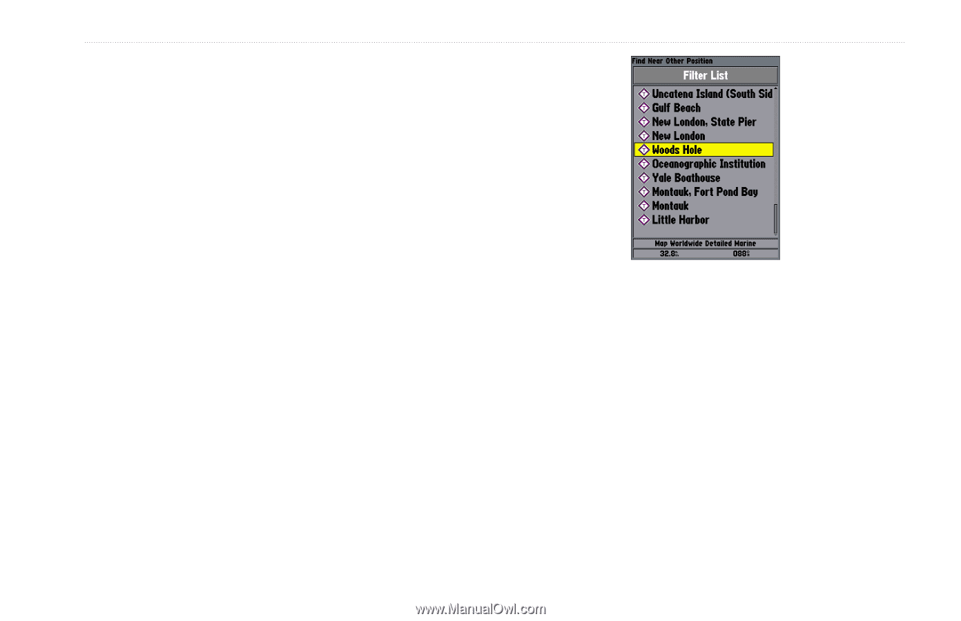
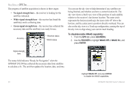
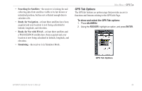
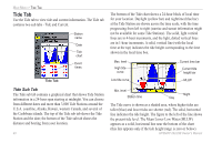
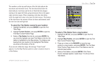
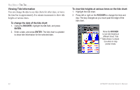
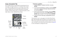
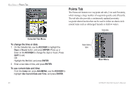
The numbers on the top and bottom of the left side indicate the maximum and minimum levels. The four data fields below the chart indicate event times and levels at which the tide changes starting in the upper-left field, going downward, then to the upperright, and down again. When comparing with other tide tables, verify the depth unit value is the same for both sources. The bottom of the chart shows the amount of time (in hours and minutes) until the next low tide and high tide. To select the Tide Station nearest to your location: 1. Highlight the At field, and press ENTER to open the Find Tides Page. 2. Highlight Current Position, and press ENTER to open the Find Near Current Position Page. 3. Select a Tide Station from the list, and press ENTER. As you move the highlight over each Tide Station in the list, the station is highlighted on the Map window. The distance and bearing from your location to the highlighted Tide Station are shown at the bottom of the list. If you are not within this range, the message "None Found" appears. Use the Map Position option to select a location closer to a Tide Station. GPSMAP 292/298 Owner's Manual MAIN MENU > TIDE TAB Select from a list of stations. To select a Tide Station from a map location: 1. Highlight the At field, and press ENTER to open the Find Tides Page. 2. Highlight Map Position, and press ENTER to open the Find Near Current Position Page. 3. Press up or down on the ROCKER to move the map pointer to a map location, and press ENTER. The Find Near Other Position Page shows a list of Tide Stations near the selected map location. 4. Select a Tide Station, and press ENTER. If the "None Found" message appears, repeat steps 1-3 until you find a Tide Station. 41
-
 1
1 -
2
-
3
-
4
-
5
-
6
-
7
-
8
-
9
-
10
-
11
-
12
-
13
-
14
-
15
-
16
-
17
-
18
-
19
-
20
-
21
-
22
-
23
-
24
-
25
-
26
-
27
-
28
-
29
-
30
-
31
-
32
-
33
-
34
-
35
-
36
-
37
-
38
-
39
-
40
-
41
-
 42
42 -
 43
43 -
 44
44 -
 45
45 -
 46
46 -
 47
47 -
 48
48 -
 49
49 -
 50
50 -
 51
51 -
 52
52 -
53
-
54
-
55
-
56
-
57
-
58
-
59
-
60
-
61
-
62
-
63
-
64
-
65
-
66
-
67
-
68
-
69
-
70
-
71
-
72
-
73
-
74
-
75
-
76
-
77
-
78
-
79
-
80
-
81
-
82
-
83
-
84
-
85
-
86
-
87
-
88
-
89
-
90
-
91
-
92
-
93
-
94
-
95
-
96
-
97
-
98
-
99
-
100
-
101
-
102
-
103
-
104
-
105
-
106
-
107
-
108
-
109
-
110
-
111
-
112
-
113
-
114
-
115
-
116
-
117
-
118
-
119
-
120
 |
 |