Garmin GPSMAP 298C Owner's Manual - Page 40
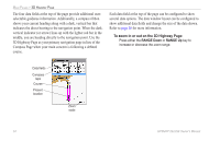
To zoom in or out on the 3D Highway
 |
UPC - 753759052072
View all Garmin GPSMAP 298C manuals
Add to My Manuals
Save this manual to your list of manuals |
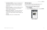
Page 40 highlights
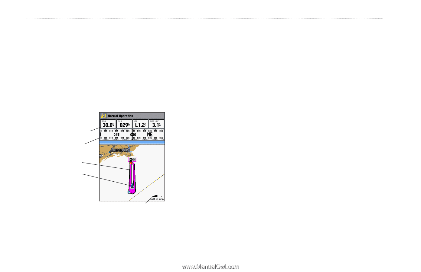
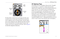
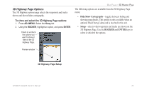
MAIN PAGES > 3D HIGHWAY PAGE The four data fields at the top of the page provide additional userselectable guidance information. Additionally, a compass ribbon shows your current heading along with a dark, vertical bar that indicates the direct bearing to the navigation point. When the dark, vertical indicator (or arrow) lines up with the lighter red bar in the middle, you are heading directly to the navigation point. Use the 3D Highway Page as your primary navigation page in lieu of the Compass Page when your main concern is following a defined course. Each data field at the top of the page can be configured to show several data options. The data window layout can be configured to show additional data fields and change the size of the data shown. Refer to page 30 for more information. To zoom in or out on the 3D Highway Page: Press either the RANGE Down or RANGE Up key to increase or decrease the zoom range. Data fields Compass tape Course Present location Zoom scale 34 GPSMAP 292/298 Owner's Manual
-
 1
1 -
2
-
3
-
4
-
5
-
6
-
7
-
8
-
9
-
10
-
11
-
12
-
13
-
14
-
15
-
16
-
17
-
18
-
19
-
20
-
21
-
22
-
23
-
24
-
25
-
26
-
27
-
28
-
29
-
30
-
31
-
32
-
33
-
34
-
 35
35 -
 36
36 -
 37
37 -
 38
38 -
 39
39 -
 40
40 -
 41
41 -
 42
42 -
 43
43 -
 44
44 -
 45
45 -
46
-
47
-
48
-
49
-
50
-
51
-
52
-
53
-
54
-
55
-
56
-
57
-
58
-
59
-
60
-
61
-
62
-
63
-
64
-
65
-
66
-
67
-
68
-
69
-
70
-
71
-
72
-
73
-
74
-
75
-
76
-
77
-
78
-
79
-
80
-
81
-
82
-
83
-
84
-
85
-
86
-
87
-
88
-
89
-
90
-
91
-
92
-
93
-
94
-
95
-
96
-
97
-
98
-
99
-
100
-
101
-
102
-
103
-
104
-
105
-
106
-
107
-
108
-
109
-
110
-
111
-
112
-
113
-
114
-
115
-
116
-
117
-
118
-
119
-
120
 |
 |