Garmin GPSMAP 298C Owner's Manual - Page 82
Show/Hide Pointer, To mark an underwater waypoint
 |
UPC - 753759052072
View all Garmin GPSMAP 298C manuals
Add to My Manuals
Save this manual to your list of manuals |
Page 82 highlights
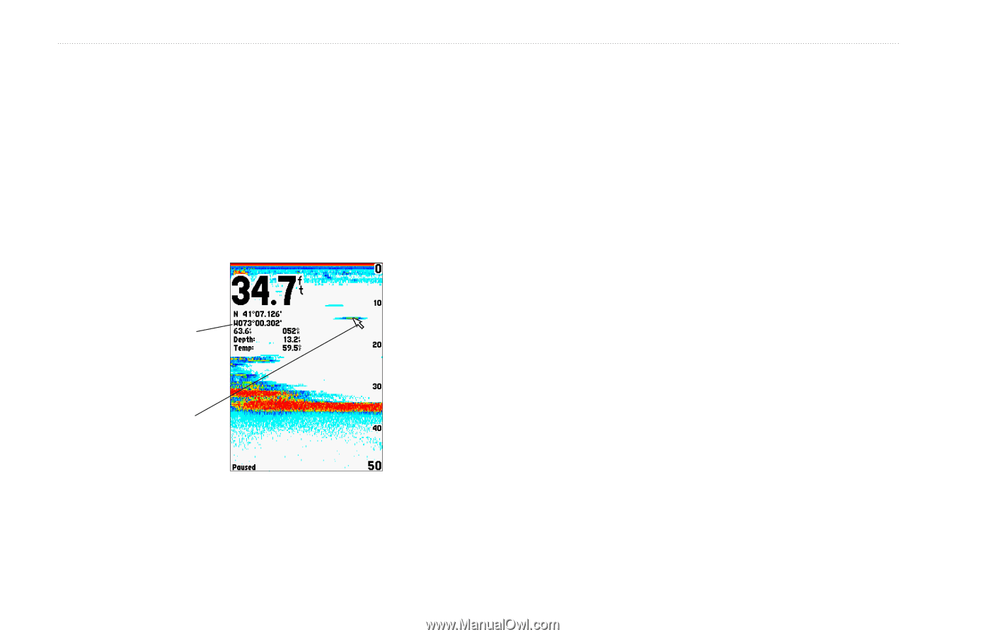
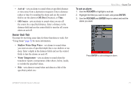
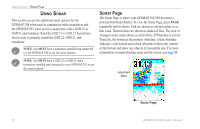
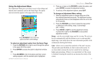
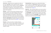
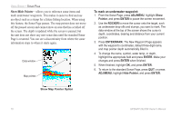
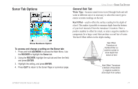
USING SONAR > SONAR PAGE Show/Hide Pointer-allows you to reference sonar items and mark underwater waypoints. This makes it easier to find and use an object such as a stump for a future fishing location. When using this feature, the Sonar Page pauses. The map pointer does not move off the paused screen and cannot show an area that has scrolled off the screen. The depth is updated while the screen is paused, but the unit does not show any new sonar data until the standard Sonar Page is resumed. You can see a discontinuity from where the sonar information stops to where it starts again. Data window Map pointer To mark an underwater waypoint: 1. From the Sonar Page, press ADJ/MENU, highlight Show Pointer, and press ENTER to pause the screen movement. 2. Use the ROCKER to move the cursor onto the target, such as underwater drop-offs and stumps, you want to mark. The data window at the top of the screen shows the cursor's depth, coordinates, bearing and distance from your current position. 3. Press ENTER/MARK. The New Waypoint Page appears with the waypoint's coordinates, default three-digit name, and map pointer depth automatically filled in. 4. To change the name, symbol, water temp, or depth, highlight the appropriate field and press ENTER. Make your changes and press ENTER when finished. 5. When finished, highlight OK, and press ENTER. 6. To return to the standard Sonar Page, press QUIT; or press ADJ/MENU, highlight Hide Pointer, and press ENTER. Show Map Pointer Option 76 GPSMAP 292/298 Owner's Manual
-
 1
1 -
2
-
3
-
4
-
5
-
6
-
7
-
8
-
9
-
10
-
11
-
12
-
13
-
14
-
15
-
16
-
17
-
18
-
19
-
20
-
21
-
22
-
23
-
24
-
25
-
26
-
27
-
28
-
29
-
30
-
31
-
32
-
33
-
34
-
35
-
36
-
37
-
38
-
39
-
40
-
41
-
42
-
43
-
44
-
45
-
46
-
47
-
48
-
49
-
50
-
51
-
52
-
53
-
54
-
55
-
56
-
57
-
58
-
59
-
60
-
61
-
62
-
63
-
64
-
65
-
66
-
67
-
68
-
69
-
70
-
71
-
72
-
73
-
74
-
75
-
76
-
 77
77 -
 78
78 -
 79
79 -
 80
80 -
 81
81 -
 82
82 -
 83
83 -
 84
84 -
 85
85 -
 86
86 -
 87
87 -
88
-
89
-
90
-
91
-
92
-
93
-
94
-
95
-
96
-
97
-
98
-
99
-
100
-
101
-
102
-
103
-
104
-
105
-
106
-
107
-
108
-
109
-
110
-
111
-
112
-
113
-
114
-
115
-
116
-
117
-
118
-
119
-
120
 |
 |