Garmin iQue M5 Que Applications Guide - Page 12
Using the Pan Toolbar, Zoom In/Zoom Out, Zoom Tool, Measure Distance, Information
 |
UPC - 753759047276
View all Garmin iQue M5 manuals
Add to My Manuals
Save this manual to your list of manuals |
Page 12 highlights
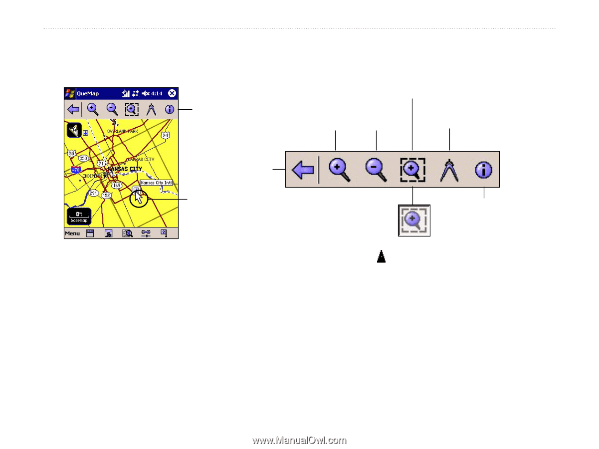
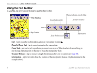
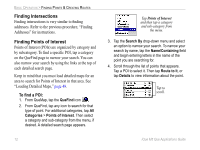
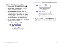
BASIC OPERATION > USING THE PAN TOOLBAR Using the Pan Toolbar In QueMap, tap anywhere on the map to open the Pan Toolbar. Pan Toolbar Zoom In/Zoom Out When deselected, pan the Map. Measure Distance Exit Map Pointer Zoom Tool selected Information Exit-tap to close the toolbar and re-center on your current position . Zoom In/Zoom Out-tap to zoom in or out on the map pointer. Zoom Tool-when selected, tap and drag to zoom in on an area. When deselected, tap and drag to pan the map. Tap any point on the map to place the map pointer there. Measure Distance-tap to measure straight-line distances between two points (see page 32). Information-tap to view info about the position of the map pointer (Kansas City International in the example above). 8 iQue M5 Que Applications Guide
-
 1
1 -
2
-
3
-
4
-
5
-
6
-
 7
7 -
 8
8 -
 9
9 -
 10
10 -
 11
11 -
 12
12 -
 13
13 -
 14
14 -
 15
15 -
 16
16 -
 17
17 -
18
-
19
-
20
-
21
-
22
-
23
-
24
-
25
-
26
-
27
-
28
-
29
-
30
-
31
-
32
-
33
-
34
-
35
-
36
-
37
-
38
-
39
-
40
-
41
-
42
-
43
-
44
-
45
-
46
-
47
-
48
-
49
-
50
-
51
-
52
-
53
-
54
-
55
-
56
-
57
-
58
-
59
-
60
-
61
-
62
-
63
-
64
-
65
-
66
-
67
-
68
-
69
-
70
 |
 |