Garmin iQue M5 Que Applications Guide - Page 50
Appendix, About QueGPS
 |
UPC - 753759047276
View all Garmin iQue M5 manuals
Add to My Manuals
Save this manual to your list of manuals |
Page 50 highlights
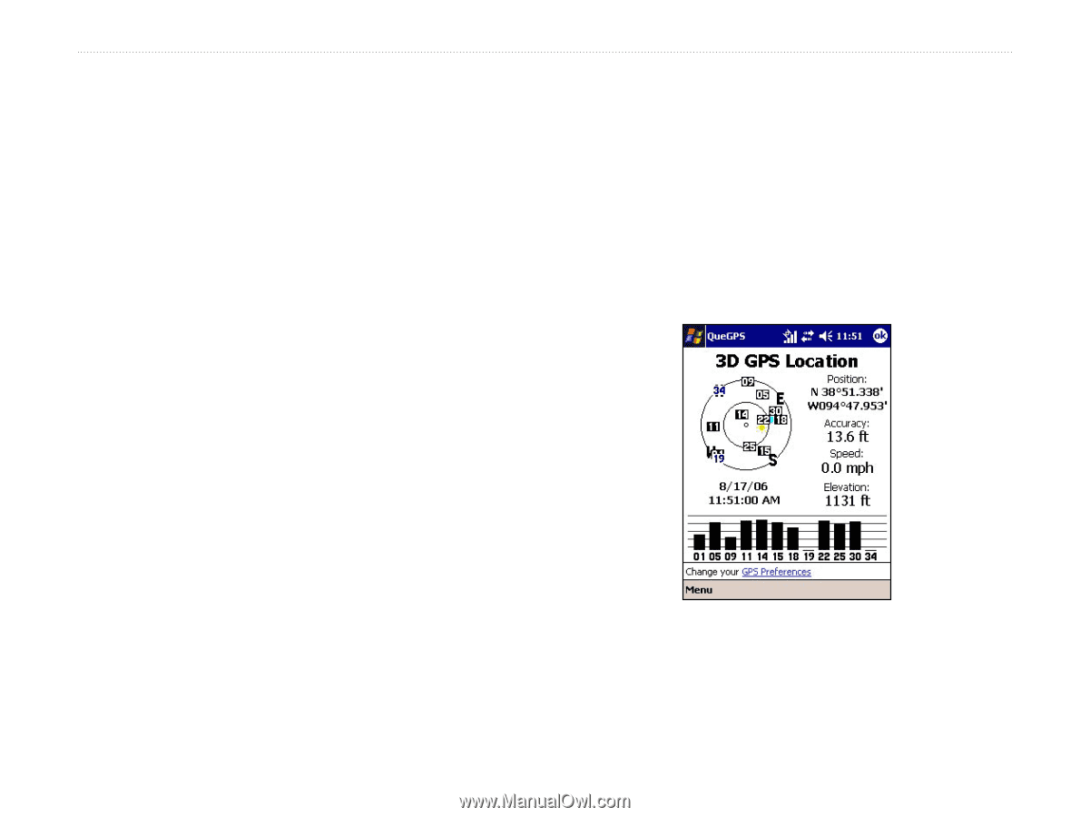
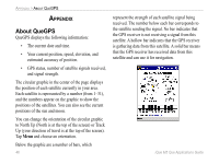
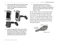
APPENDIX > ABOUT QUEGPS APPENDIX About QueGPS QueGPS displays the following information: • The current date and time. • Your current position, speed, elevation, and estimated accuracy of position. • GPS status, number of satellite signals received, and signal strength. The circular graphic in the center of the page displays the position of each satellite currently in your area. Each satellite is represented by a number (from 1-31), and the numbers appear on the graphic to show the positions of the satellites. You can also see the current positions of the sun and moon. You can change the orientation of the circular graphic to North Up (North is at the top of the screen) or Track Up (your direction of travel is at the top of the screen). Tap Menu and choose an orientation. Below the graphic are a number of bars, which 46 represent the strength of each satellite signal being received. The number below each bar corresponds to the satellite sending the signal. No bar indicates that the GPS receiver is not receiving a signal from this satellite. A hollow bar indicates that the GPS receiver is gathering data from this satellite. A solid bar means that the GPS receiver has received data from this satellite and can use it for navigation. iQue M5 Que Applications Guide
-
 1
1 -
2
-
3
-
4
-
5
-
6
-
7
-
8
-
9
-
10
-
11
-
12
-
13
-
14
-
15
-
16
-
17
-
18
-
19
-
20
-
21
-
22
-
23
-
24
-
25
-
26
-
27
-
28
-
29
-
30
-
31
-
32
-
33
-
34
-
35
-
36
-
37
-
38
-
39
-
40
-
41
-
42
-
43
-
44
-
 45
45 -
 46
46 -
 47
47 -
 48
48 -
 49
49 -
 50
50 -
 51
51 -
 52
52 -
 53
53 -
 54
54 -
 55
55 -
56
-
57
-
58
-
59
-
60
-
61
-
62
-
63
-
64
-
65
-
66
-
67
-
68
-
69
-
70
 |
 |