Garmin Forerunner 955 Solar Owners Manual - Page 116
Map Themes, Marine Map Settings, Showing and Hiding Map Data, Navigation Settings
 |
View all Garmin Forerunner 955 Solar manuals
Add to My Manuals
Save this manual to your list of manuals |
Page 116 highlights
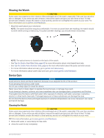
Map Themes You can change the map theme to display data optimized for your activity type. Hold , and select Map > Map Theme. None: Uses the preferences from the system map settings, with no additional theme applied. High Contrast: Sets the map to display data with higher contrast, for better visibility in challenging environments. Dark: Sets the map to display data with a dark background, for better visibility at night. Popularity: Highlights the most popular roads or trails on the map. Marine Map Settings You can customize how the map appears in marine mode. Hold , and select Map > Marine. Spot Soundings: Enables depth measurements on the chart. Light Sectors: Shows and configures the appearance of light sectors on the chart. Symbol Set: Sets the chart symbols in marine mode. The NOAA option displays the National Oceanic and Atmospheric Administration chart symbols. The International option displays the International Association of Lighthouse Authorities chart symbols. Showing and Hiding Map Data If you have multiple maps installed on your device, you can choose the map data to show on the map. 1 Press START. 2 Select Map. 3 Hold . 4 Select the map settings. 5 Select Map > Configure Maps. 6 Select a map to activate the toggle switch, which shows or hides the map data. Navigation Settings You can customize the map features and appearance when navigating to a destination. Customizing Navigation Data Screens 1 Hold . 2 Select Navigation > Data Screens. 3 Select an option: • Select Map > Status to turn on or off the map. • Select Map > Data Field to turn on or off a data field that shows routing information on the map. • Select Up Ahead to turn on or off information about upcoming course points. • Select Compass to turn on or off the compass. • Select Elevation Plot to turn on or off the elevation plot. • Select a screen to add, remove, or customize. Setting Up a Heading Bug You can set up a heading indicator to display on your data pages while navigating. The indicator points to your target heading. 1 Hold . 2 Select Navigation > Heading Bug. 108 Customizing Your Watch
-
 1
1 -
2
-
3
-
4
-
5
-
6
-
7
-
8
-
9
-
10
-
11
-
12
-
13
-
14
-
15
-
16
-
17
-
18
-
19
-
20
-
21
-
22
-
23
-
24
-
25
-
26
-
27
-
28
-
29
-
30
-
31
-
32
-
33
-
34
-
35
-
36
-
37
-
38
-
39
-
40
-
41
-
42
-
43
-
44
-
45
-
46
-
47
-
48
-
49
-
50
-
51
-
52
-
53
-
54
-
55
-
56
-
57
-
58
-
59
-
60
-
61
-
62
-
63
-
64
-
65
-
66
-
67
-
68
-
69
-
70
-
71
-
72
-
73
-
74
-
75
-
76
-
77
-
78
-
79
-
80
-
81
-
82
-
83
-
84
-
85
-
86
-
87
-
88
-
89
-
90
-
91
-
92
-
93
-
94
-
95
-
96
-
97
-
98
-
99
-
100
-
101
-
102
-
103
-
104
-
105
-
106
-
107
-
108
-
109
-
110
-
 111
111 -
 112
112 -
 113
113 -
 114
114 -
 115
115 -
 116
116 -
 117
117 -
 118
118 -
 119
119 -
 120
120 -
 121
121 -
122
-
123
-
124
-
125
-
126
-
127
-
128
-
129
-
130
-
131
-
132
-
133
-
134
-
135
-
136
-
137
-
138
-
139
-
140
-
141
-
142
-
143
-
144
-
145
-
146
 |
 |