Kenwood TH-D75 User Manual - Page 52
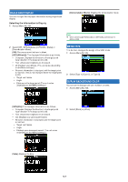
OUTPUT DESTINATION INTERFACE (USB/Bluetooth), Setting the Data Band DV/DR Interface
 |
View all Kenwood TH-D75 manuals
Add to My Manuals
Save this manual to your list of manuals |
Page 52 highlights
Setting the Altitude, Rainfall 1 Access Menu No. 971. 2 Select [feet, inch] or [m, mm]. Setting the Temperature 1 Access Menu No. 972. OUTPUT DESTINATION INTERFACE (USB/Bluetooth) Set the interface to use for each of the following applications. Select [USB] or [Bluetooth]. • GPS data (NMEA) output • APRS packet output • KISS mode (input and output) • DV/DR mode (input and output) • DV Gateway mode (input and output) Setting the PC Output (GPS) Interface 1 Access Menu No. 981. 2 Select [°F] or [°C]. Setting the Latitude longitude 1 Access Menu No. 973. 2 Select [USB] or [Bluetooth]. Setting the PC Output (APRS) Interface 1 Access Menu No. 982. 2 Select [dd°mm.mm' ], or [dd°mm'ss.s" "]. Setting the Grid Square Format 1 Access Menu No. 974. 2 Select [USB] or [Bluetooth]. Setting the Data Band (KISS) Interface 1 Access Menu No. 983. 2 Select [Maidenhead Grid], [SAR Grid (CONV)], or [SAR Grid (CELL)]. [Maidenhead Grid]: This Grid Square format is commonly used in amateur radio. [SAR Grid (CONV)]: Conventional format (old format) for Search & Rescue (old format) is used in the United States. [SAR Grid (CELL)]: Cell format (new format) for Search & Rescue is used in the United States. 2 Select [USB] or [Bluetooth]. Setting the Data Band (DV/DR) Interface 1 Access Menu No. 984. 2 Select [USB] or [Bluetooth]. 12-12
-
 1
1 -
2
-
3
-
4
-
5
-
6
-
7
-
8
-
9
-
10
-
11
-
12
-
13
-
14
-
15
-
16
-
17
-
18
-
19
-
20
-
21
-
22
-
23
-
24
-
25
-
26
-
27
-
28
-
29
-
30
-
31
-
32
-
33
-
34
-
35
-
36
-
37
-
38
-
39
-
40
-
41
-
42
-
43
-
44
-
45
-
46
-
 47
47 -
 48
48 -
 49
49 -
 50
50 -
 51
51 -
 52
52 -
 53
53 -
 54
54 -
 55
55 -
 56
56 -
 57
57 -
58
-
59
-
60
-
61
-
62
-
63
-
64
-
65
-
66
-
67
-
68
-
69
-
70
-
71
-
72
-
73
-
74
-
75
-
76
-
77
-
78
-
79
-
80
-
81
-
82
-
83
-
84
-
85
-
86
-
87
-
88
-
89
-
90
-
91
-
92
-
93
-
94
-
95
-
96
-
97
-
98
-
99
-
100
-
101
-
102
-
103
-
104
-
105
-
106
-
107
-
108
-
109
-
110
-
111
-
112
-
113
-
114
-
115
-
116
-
117
-
118
-
119
-
120
-
121
-
122
-
123
-
124
-
125
-
126
-
127
-
128
-
129
-
130
-
131
-
132
-
133
 |
 |
