Nextar Q4-MD User Manual - Page 18
Enabling Smart Zoom, Fine-tuning Smart Zoom, 4.2 Position markers
 |
UPC - 714129929912
View all Nextar Q4-MD manuals
Add to My Manuals
Save this manual to your list of manuals |
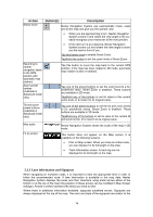
Page 18 highlights
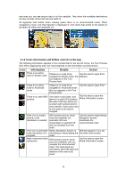
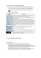
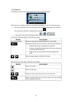
Enabling Smart Zoom Tap the map to let the map control buttons appear, and then tap to enable Smart Zoom. Fine-tuning Smart Zoom Tap the map to let the map control buttons appear, and then tap and hold to open the Smart Zoom Settings window. Modify the zoom limits of Smart Zoom if necessary. 2.4.2 Position markers 2.4.2.1 Current GPS position and Lock-on-Road When your GPS position is available, Nextar Navigation System marks your current position with the icon on the map. The exact location of the position marker depends on the vehicle type used for route calculation. The vehicle type can be selected in Route settings (page 74) or in the Quick Menu (page 64). • If you choose pedestrian: The icon is at your exact GPS position. The direction of the icon shows your actual heading. • If you choose any of the vehicles: The icon is aligned to the nearest road to suppress GPS position errors. The direction of the icon is one of the directions of the route. To use the current GPS position, tap the GPS position as one of the following: • a Favorite • a POI • a map marker Pin . The Position menu appears and you can save 2.4.2.2 Returning to normal navigation When GPS position is available, and you have moved the map (the icon is moving or is not even visible), or you have rotated the map in 3D mode, the button appears. Tap it to move the map back to the GPS position and re-enable Track-up map orientation (automatic map rotation). 19
-
 1
1 -
2
-
3
-
4
-
5
-
6
-
7
-
8
-
9
-
10
-
11
-
12
-
 13
13 -
 14
14 -
 15
15 -
 16
16 -
 17
17 -
 18
18 -
 19
19 -
 20
20 -
 21
21 -
 22
22 -
 23
23 -
24
-
25
-
26
-
27
-
28
-
29
-
30
-
31
-
32
-
33
-
34
-
35
-
36
-
37
-
38
-
39
-
40
-
41
-
42
-
43
-
44
-
45
-
46
-
47
-
48
-
49
-
50
-
51
-
52
-
53
-
54
-
55
-
56
-
57
-
58
-
59
-
60
-
61
-
62
-
63
-
64
-
65
-
66
-
67
-
68
-
69
-
70
-
71
-
72
-
73
-
74
-
75
-
76
-
77
-
78
-
79
-
80
-
81
-
82
-
83
-
84
-
85
 |
 |