Pioneer AVIC-D1 Owner's Manual - Page 111
Positioning Technology, Positioning by GPS, Positioning by dead reckoning, How do GPS and dead
 |
UPC - 012562739496
View all Pioneer AVIC-D1 manuals
Add to My Manuals
Save this manual to your list of manuals |
Page 111 highlights
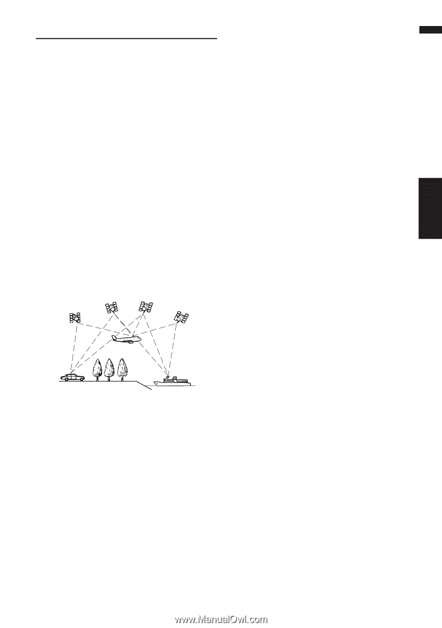
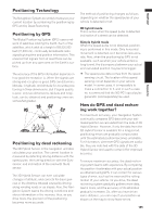
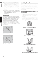
Positioning Technology The Navigation System accurately measures your current location by combining the positioning by GPS and by Dead Reckoning. Positioning by GPS The Global Positioning System (GPS) uses a network of satellites orbiting the Earth. Each of the satellites, which orbit at a height of 68,900,000 feet (21,000 km), continually broadcasts radio signals giving time and position information. This ensures that signals from at least three can be picked up from any open area on the Earth's surface. The accuracy of the GPS information depends on how good the reception is. When the signals are strong and reception is good, GPS can determine latitude, longitude, and altitude for accurate positioning in three dimensions. But if signal quality is poor, only two dimensions, latitude and longitude, can be obtained and positioning errors are somewhat greater. Positioning by dead reckoning The 3D Hybrid Sensor in the navigation unit also calculates your position. The current location is measured by detecting driving distance with the speed pulse, the turning direction with the Gyrosensor, and inclination of the road with the G sensor. The 3D Hybrid Sensor can even calculate changes of altitude, and corrects for discrepancies in the distance traveled caused by driving along winding roads or up slopes. Also, the Navigation System learns the driving conditions and stores information in the memory; thus, as you drive more, the precision of the positioning becomes more accurate. The method of positioning changes as follows depending on whether the speed pulse of your vehicle is detected or not: 3D hybrid mode This is active when the speed pulse is detected. Inclination of a street can be detected. Simple hybrid mode When the speed pulse is not detected, positioning is performed in this mode. Only horizontal movement is detected, so it becomes less accurate. Also, when the positioning by GPS is not available, such as when your vehicle enters a long tunnel, the discrepancy between your actual and calculated position may become bigger. ❒ The speed pulse data comes from the speed sensing circuit. The location of this speed sensing circuit depends on your vehicle model. In some cases, it is impossible to make a connection to it, and in such a case we recommend that the ND-PG1 speed pulse generator (sold separately) be used. How do GPS and dead reckoning work together? For maximum accuracy, your Navigation System continually compares GPS data with your estimated position as calculated from the data of 3D Hybrid Sensor. However, if only the data from the 3D Hybrid Sensor is available for a long period, positioning errors are gradually compounded until the estimated position becomes unreliable. For this reason, whenever GPS signals are available, they are matched with the data of the 3D Hybrid Sensor and used to correct it for improved accuracy. To ensure maximum accuracy, the dead reckoning system learns with experience. By comparing the position it estimates with your actual position as obtained using GPS, it can correct for various types of error, such as tire wear and the rolling motion of your vehicle. As you drive, the dead reckoning system gradually gathers more data, learns more, and the accuracy of its estimates gradually increases. So, after you have driven some distance, you can expect your position as shown on the map to show fewer errors. 109 Appendix NAVI/AV
-
 1
1 -
2
-
3
-
4
-
5
-
6
-
7
-
8
-
9
-
10
-
11
-
12
-
13
-
14
-
15
-
16
-
17
-
18
-
19
-
20
-
21
-
22
-
23
-
24
-
25
-
26
-
27
-
28
-
29
-
30
-
31
-
32
-
33
-
34
-
35
-
36
-
37
-
38
-
39
-
40
-
41
-
42
-
43
-
44
-
45
-
46
-
47
-
48
-
49
-
50
-
51
-
52
-
53
-
54
-
55
-
56
-
57
-
58
-
59
-
60
-
61
-
62
-
63
-
64
-
65
-
66
-
67
-
68
-
69
-
70
-
71
-
72
-
73
-
74
-
75
-
76
-
77
-
78
-
79
-
80
-
81
-
82
-
83
-
84
-
85
-
86
-
87
-
88
-
89
-
90
-
91
-
92
-
93
-
94
-
95
-
96
-
97
-
98
-
99
-
100
-
101
-
102
-
103
-
104
-
105
-
 106
106 -
 107
107 -
 108
108 -
 109
109 -
 110
110 -
 111
111 -
 112
112 -
 113
113 -
 114
114 -
 115
115 -
 116
116 -
117
-
118
-
119
-
120
-
121
-
122
-
123
-
124
-
125
-
126
-
127
-
128
-
129
-
130
-
131
-
132
-
133
 |
 |